Fishing for brook trout in Washburn Pond in Woodstock, Oxford County, Maine (June 19, 2021)


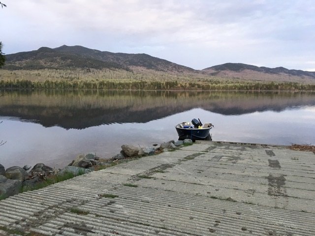
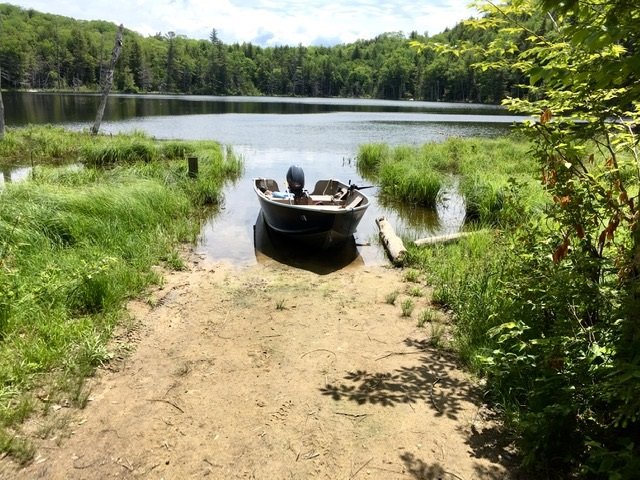
The boat launch is narrow and rather shallow.


Washburn Pond covers 12 acres and is located in Woodstock Township in Oxford County, Maine (see The Maine Atlas and Gazetteer map 11 A1). To reach this pond going north, drive down Redding Road and turn right on Washburn Pond Road right before reaching Sagg Pond. This 0.3 mile-long dirt road ends at Washburn Pond. Although it is rough in spots, the road will accommodate two-wheel drive cars. The pond has an unimproved and rather shallow sandy boat launch. I had to back my trailer about 30 ft. into the water before my boat would finally float off. The launch is also hemmed in by emergent aquatic vegetation on both sides. Hence, space is lacking to park the boat on shore AND back the trailer into the water at the same time. I was glad I brought my hip boots so I could place my boat in the vegetation to the side, back my trailer into the water, and then float the boat onto the trailer.


Continue reading

Digiprove sealCopyright protected by Digiprove
Fishing for brook trout in North Otter Pond in Bowtown Township, Somerset County, Maine (May 28, 2021)


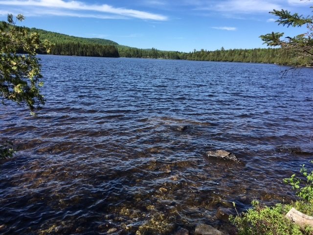
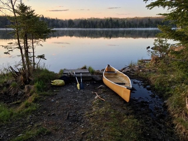
View of North Otter Pond from the public access point


North Otter Pond covers 71 acres and is located in Bowtown Township in Somerset County, Maine (see The Maine Atlas and Gazetteer map 30 A2). This pond can be reached as follows: from North New Portland (see The Maine Atlas and Gazetteer map 30 E2), drive north on Long Falls Dam Road for about 23 miles and turn right on Carrying Place Road at the sign for Cobb’s Camps. Drive down this gravel road for 10.1 miles until the Yield traffic sign and turn left on Bowtown Road (note: Google Maps calls this road “Otter Pond Road”). Pass Harrison Camp on the left, cross Pierce Pond Stream and drive for another 3 miles or so. Turn left on a short dirt road which dead-ends in the woods. The pond and its unofficial public access point are visible through the trees. Both Carrying Place Road and Bowtown Road are gravel logging roads which are drivable by regular cars but can be rough during mud season in early spring. It took us about one hour to cover the 15 miles or so from the turn-off on Long Falls Dam Road to the pond. Hence, this pond is reachable by car even though it is rather remote. A boat launch is not available and only hand-carried craft can be placed in the water from the rough access point at the southern tip of the pond.


Continue reading

Digiprove sealCopyright protected by Digiprove

Fishing for brook trout on Shadow Pond in Greenville, Piscataquis County, Maine (May 16, 2021)


Shadow Pond is an 18-acre body of water located in Greenville, Piscataquis County, Maine (see The Maine Atlas and Gazetteer Map 41 D2). The public access point is off Rockwood Road (Route 6/15) which runs right along the northern tip of the pond. Only hand-carried craft can be launched from this location.


Continue reading

Digiprove sealCopyright protected by Digiprove

Fishing for brook trout on Mountainview Pond (a.k.a. Fitzgerald Pond) in Big Moose Township, Piscataquis County (May 16, 2021).


The view from the boat launch is quite stunning!


Mountainview Pond (a.k.a. Fitzgerald Pond) is a 550-acre body of water located at the base of Big Moose Mountain and the Big Squaw Ski Resort a few miles west outside of Greenville, Piscataquis County, Maine (see The Maine Atlas and Gazetteer map 41 C1). Access is off Rockwood Road (Route 6/15) down a gravel road to an excellent hard-top boat launch with ample parking space available. A big sign on Rockwood Road clearly indicates the access point to the pond.


Continue reading

Digiprove sealCopyright protected by Digiprove

Fishing for brook trout on Salmon Pond in Greenville, Piscataquis County, Maine (May 15, 2021).


The rough launch can only accommodate hand-carried craft.


Salmon Pond is a 12-acre body of water located a few miles outside of Greenville, Piscataquis County, Maine (see The Maine Atlas and Gazetteer map 41 D3). Access is via an old logging road off the Katahdin Iron Works (KI) Road. I was able to easily find it using my phone’s GPS thanks to a strong signal coming from Greenville. The KI Road, and the side road leading to the pond, are rough in spots but quite drivable using a regular car. Hence, no need for a four-wheel drive vehicle. The pond is accessible by foot via a short forest trail. Only hand-carried craft can be launched on it.


Continue reading

Digiprove sealCopyright protected by Digiprove

Fishing for brook trout on Secret Pond in Greenville, Piscataquis County (May 15, 2021).


Geovanni is all kitted up and ready to go!


Secret Pond is a small but deep 14-acre body of water located a few miles outside of Greenville, Piscataquis County, Maine (see The Maine Atlas and Gazetteer map 41 D3). Access is via an old logging road off the Katahdin Iron Works (KI) Road. I was able to easily find it using my phone’s GPS thanks to a strong signal coming from Greenville. The KI Road, and the side road leading to the pond, are rough in spots but quite drivable using a regular car. Hence, no need for a four-wheel drive vehicle. The pond is accessible by foot via a short forest trail. Only hand-carried craft can be launched on it.


Continue reading

Digiprove sealCopyright protected by Digiprove

Fishing for brook trout on Sawyer Pond in Greenville, Piscataquis County (May 14, 2021).


The launch at Sawyer Pond can only accommodate hand-carried craft.


Sawyer Pond is 67-acre body of water located off Scammon Road a few miles outside of Greenville, Piscataquis County, Maine (see The Maine Atlas and Gazetteer map 41 D3). I was able to easily find it using my phone’s GPS thanks to a strong signal coming from Greenville. The Maine Atlas and Gazetteer shows a launch for trailered boats on the eastern shore. Do not believe it! Only hand-carried craft can be released from that location, as I found out the hard way. Ample parking is available nearby.


Continue reading

Digiprove sealCopyright protected by Digiprove

Fishing for brook trout on Grenell Pond in Greenville, Piscataquis County (May 9, 2021)


Grenell Pond supports a native and genetically pure brook trout population


Grenell Pond is a small 6-acre body of water located a few miles outside of Greenville, Piscataquis County, Maine (see The Maine Atlas and Gazetteer map 41 D3). Access is via an old logging road off the Katahdin Iron Works (KI) Road. I was able to easily find it using my phone’s GPS thanks to a strong signal coming from Greenville. The KI Road, and the side road leading to the pond, are rough in spots but quite drivable using a regular car. Hence, no need for a four wheel-drive vehicle. The pond is accessible by foot via a short forest trail. Only hand-carried craft can be launched on it.


Continue reading

Digiprove sealCopyright protected by Digiprove

Fishing for brook trout on Echo Lake in Acadia National Park on Mount Desert Island, Maine (May 9, 2021).


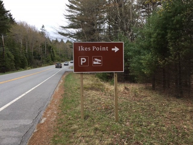
The boat launch for Echo Lake is by Ikes Point off Busy Route 102.


Echo Lake covers 237 acres and is partially located in Acadia National Park on Mount Desert Island (MDI) in Hancock County, Maine (see The Maine Atlas and Gazetteer map 16 C2). Access is down an unnamed Park road off Route 102. Look for the “Ikes Point” sign. Drive down this short Park road, passed the parking lot, to the public boat launch at the end. The unimproved sandy launch can accommodate trailered boats. Keep in mind that boat engines over 10 HP are not allowed on this water body. Also, be aware that you will need a pass to legally park your vehicle anywhere inside the Park, including here. The pass can be purchased on-line or at the visitor center on MDI, among other places.


Continue reading

Digiprove sealCopyright protected by Digiprove

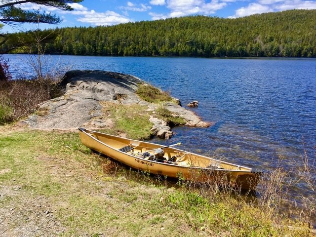
Fishing for brook trout on Lower Hadlock Pond in Acadia National Park on Mount Desert Island, Maine (May 9, 2021)


The access point can only accommodate hand-carried craft. The rock jutting out in the pond is a great place to fish from shore!


Lower Hadlock Pond covers 39 acres and is located in Acadia National Park on Mount Desert Island (MDI) in Hancock County, Maine (see The Maine Atlas and Gazetteer map 16 C3). Access is a couple of 100 ft. down Hadlock Pond Road off busy Route 3/198. Be aware that you will need a pass to legally park your vehicle anywhere inside the Park, including here. The pass can be purchased on-line or at the visitor center on MDI, among other places. The launch site can only accommodate hand-carried crafts, such as a canoe or kayak. Parking is along the road shoulder or a nearby small Park-managed gravel parking lot.


Continue reading

Digiprove sealCopyright protected by Digiprove