Largemouth bass fishing on Perley Pond, Sebago, Maine (August 25, 2012)

View Map

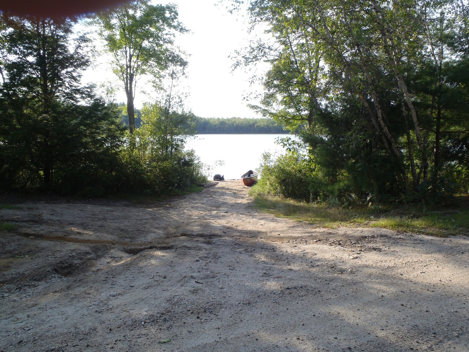
Access point to Perley Pond

Perley Pond is located in the town of Sebago (see the Maine Atlas and Gazetteer map 4 C5). To reach the pond, turn onto Folly Road from either Route 107 (Bridgton Road) or Route 114 (Sebago Road) and drive for 2-3 miles. The pond is clearly visible from Folly Road. An unimproved sandy launch allows access for small trailered boats, as well as hand-carried craft.

Continue reading

Digiprove sealCopyright protected by Digiprove

Striped bass fishing off the Scarborough River, Scarborough, Maine (July 14, 2012)


View Larger Map

I meet up with Tom D. and Tom A. at the Claypits boat launch off Clay Pits Road (see The Main Atlas and Gazetteer map 3 B4) in Scarborough at 5:30 am. We’re going after striped bass which enter the Scarborough River with the incoming tide. We have to hurry up though because high tide occurs at 8:30 am.


We motor out of the river and into the ocean to jig for small mackerel behind Bluff Island. Typically, we’d catch a dozen mackerel in 15 minutes and be ready to go after stripers. But not today… It takes us one hour to catch 4 mackerels, by which time two of them are dead. This is not a good sign, though, because stripers follow the mackerel schools and if the schools are absent, so are the stripers… We return closer to the mouth of the river and fish our remaining live bait close to the surface with a bobber. We see no striper activity, even though large schools of 2″ baitfish are swimming all around the area and the seabirds are having a feast.


Our two mackerels are dead within 45 minutes. We motor back out towards Bluff Island to catch some more. Again, it takes us one hour to catch a handful of fresh ones. We return to shore and let our new baits drift in front of Prouts Neck. Half a dozen other boats are doing the same thing. No one is catching anything.


It’s 9:30 am and the tide has turned. We’ve given it our best but the stripers decided not to come to the party… Fortunately, the weather was gorgeous, with a light southern breeze, no waves, and filtered sunshine. It was definitively worth to be on the water this early in the morning in the company of two friends.


The results: skunked : (

Was the information in this blog useful? I invite you to share your thoughts and opinions by posting a comment. Also, feel free to tell us about your experiences fishing for stripers in or around the Scarborough River.

Digiprove sealCopyright protected by Digiprove

Largemouth bass fishing on Milliken Mills Pond, Old Orchard Beach, Maine (July 21, 2012)

View Map

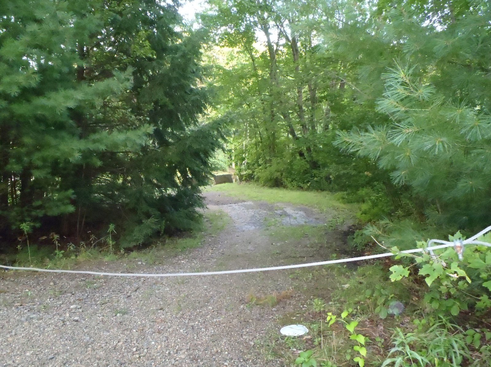
Access point to Milliken Mills Pond viewed from Milliken Mills Road

Milliken Mills Pond is an impoundment of Mill Brook (see The Maine Atlas and Gazetteer map 3 B3) in Old Orchard Beach. Access to the pond is on Milliken Mills Road, right by the dam on Portland Avenue. The launch is rough and can only handle hand-carried craft because a thick cable is stretched across the entrance way and half-a-dozen large granite blocks bar the way further down. The distance between the road and the water is no more than 150 ft. Parking is on the road shoulder and is limited to two or three cars. Even though the pond is small (10 acres), it gives the impression of being much larger because it is quite narrow (< 130 ft), and hence very long (over 0.5 mile!). The pond has little aquatic vegetation but a multitude of overhanging branches and fallen trees. The water is also crystal-clear. This small water body, located no more than 12 miles south of Portland, provides a remarkable feeling of “remoteness”. Both banks are densely wooded and devoid of houses or camps. Further upstream, the heavy canopy on both banks provides a cocoon-like feeling. Click here for a depth map and more fisheries information.


Continue reading

Digiprove sealCopyright protected by Digiprove

Landlocked salmon fishing on Peabody Pond, Sebago, Maine (April 15, 2012)

View Map

Joel and I arrive at Peabody Pond (see The Maine Atlas and Gazetteer map 4 B4) at 7:30 this morning to fish for landlocked Atlantic salmon. This 735-acre jewel of a lake (maximum depth = 64 ft) in the town of Sebago is located off Route 107 and is accessed via Peabody Pond Road. The launch ramp is concrete. Plenty of parking is available. Even though Peabody Pond is heavily developed on its western and northern shorelines, it gives the impression of a “remote” lake due to the looming presence of Bald Pate Mountain in the background. It is definitely a pretty setting. The lake is also known to produce high-quality landlocks because it supports a healthy population of rainbow smelt which allows the salmon to grow fast, big, and fat. The fact that the pond is closed to ice fishing also protects the salmon population from excessive fishing pressure in the winter. I landed a five pounder here in 2011 and know of a 6.5 pounder and a 8.0 pounder caught the year before… But I also know from experience that these fish require a lot of work to be caught!

Continue reading

Digiprove sealCopyright protected by Digiprove