Fishing for brook trout on Round Pond in Albany (White Mountain National Forest), Maine (June 8, 2019)

View Map


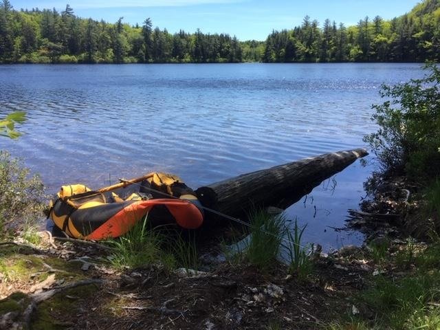
The float tube is my secret fishing weapon this afternoon!


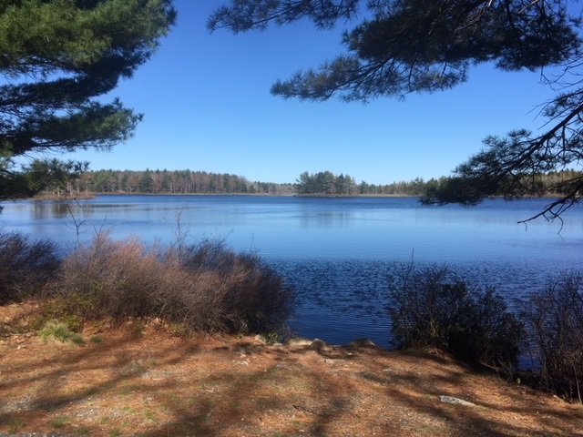
Round Pond is a picturesque 11-acre body of water located in Albany (White Mountain National Forest, WMNF), Oxford County (see The Maine Atlas and Gazetteer map 10 C3). To reach this spot, drive up to the Crocker Pond camp ground managed by the US Forest Service and leave your vehicle at the head of the Albany Brook Trail, located about 300 ft past the campground entrance. By the way, this clean and well-maintained campground is a great base to explore the tremendous hiking and fishing opportunities in the surrounding WMNF. Round Pond is an easy 1-mile hike (about 30 minutes) from camp. A serious limitation is that, unlike Baxter State Park, the Forest Service does not store a canoe along the shoreline of remote ponds for day use. Hence, you’ll have to bring your own floatation device. Two people could conceivably drag in a canoe at great metabolic cost. I carry my much lighter float tube since I’m fishing by myself this afternoon. For the record, quality fishing from shore would be a real challenge at this location because the entire shoreline is surrounded by dense shrubs
Continue reading

Digiprove sealCopyright protected by Digiprove
Ice fishing for brook trout on Chaffin Pond in Windham, Maine (December 15, 2018)

View Map

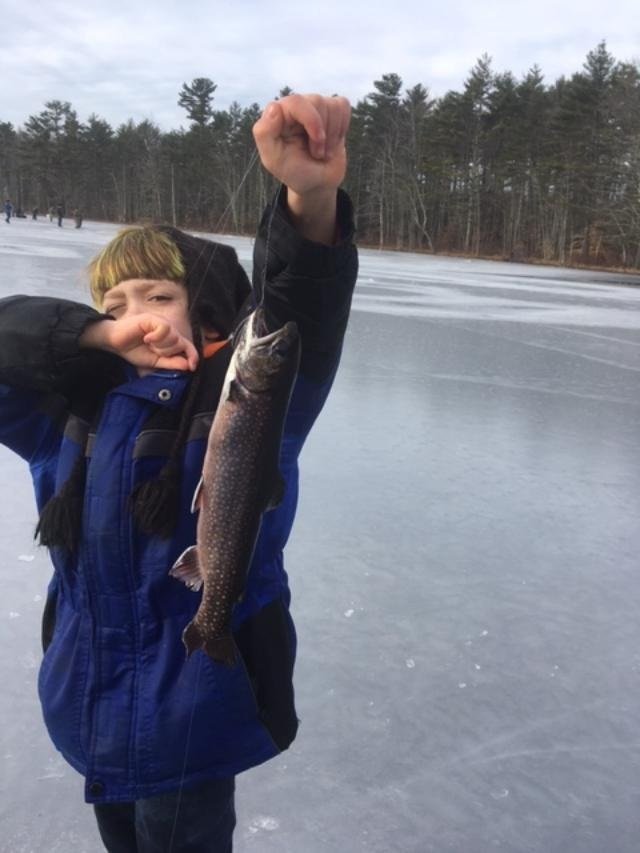
Antony proudly shows off his fish


Chaffin Pond is a pretty 13-acre body of water located in Windham, Maine (see the Maine Atlas and Gazetteer map 5 C2). Access is super-easy! Drive on Route 302 north in downtown Windham, pass the Home Depot sign (Franklin Drive) and take the next right on Chaffin Pond Reserve Drive (Donnabeth Lippman Park) just before the Sherman Williams store. The pond is a couple of 100 ft down the road. Ample parking is available.

Continue reading

Digiprove sealCopyright protected by Digiprove
Fishing for brook trout on Otter Pond #4 in Standish, Maine (November 9, 2018)

View Map

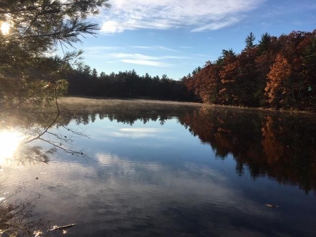
Aaahh, that rising sun feels so good on my numb fingers!


The tree leaves have all changed colors and dropped to the ground, the nights are getting decidedly colder, and winter feels like it’s just around the corner. Yet, it would be foolish to stow away the rods and reels because open-water fishing opportunities are still beckoning all over southern Maine for those willing to put in the effort! In fact, it never ceases to amaze me that we have access to a smorgasbord of fishing locations in the fall which remain largely unused. Most everyone else stops going out once it gets colder, which means that we essentially have all the hot fishing spots entirely to ourselves! That, of course, is perfectly fine with me. My blog readers have asked me in the past about locations that can be fished for trout in the fall using waders and without the need for a boat or fancy electronics. Otter Pond #4 is one of those spots.


Continue reading

Digiprove sealCopyright protected by Digiprove
Fishing for brook trout on Lower South Branch Pond in Baxter State Park, Maine (September 29, 2018)

View Map

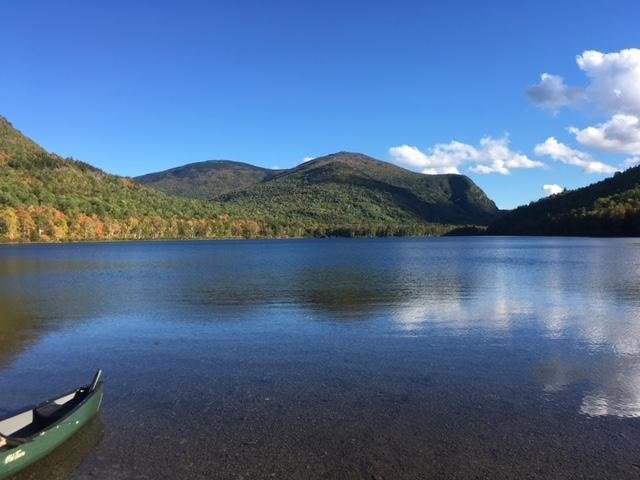
A stunning view of Lower South Branch Pond from the canoe launch area


My son Joel and I are leaving town for the weekend to partake in our annual fall camping, fishing, and hiking trip. We’ve decided to visit one of our favorite destinations to pursue these shared passions, namely Baxter State Park (BSP) in northern Maine. The plan is to fish for native brook trout on Lower South Branch Pond on Saturday afternoon, sleep at one of the lean-tos at the camp area by the pond Saturday night, and spend the next day hiking the awesome Traveler Mountains loop trail, which starts and ends at the pond. The South Branch Pond camp site is accessible by car, which makes it very convenient to get to. Camping reservations must be made in advance by contacting BSP directly. Before I get on the topic of fishing, let me say that the effort required to hike the Travelers is, in my opinion, on par with hiking Mount Kathadin located at the southern end of BSP! The Travelers hike may take up to 9 or 10 hours to complete, ascends and descends three main peaks (and numerous “false peaks”), and is quite technical, particularly the first half of the hike (Center Ridge Trail) where long stretches of the “trail” consist of enormous boulder fields that will test your ankles, knees, balance, and muscles. Keep in mind that this hike is NOT for novices or beginners. And here’s the best part. Joel and I encountered a grand total of only two people during the entire day, while I suspect that Mount Katahdin was overrun by hordes of tourists!

Continue reading

Digiprove sealCopyright protected by Digiprove

Fishing for brook trout on Witch Hole Pond in Acadia National Park on Mount Desert Island, Maine (May 11, 2018)

View Map

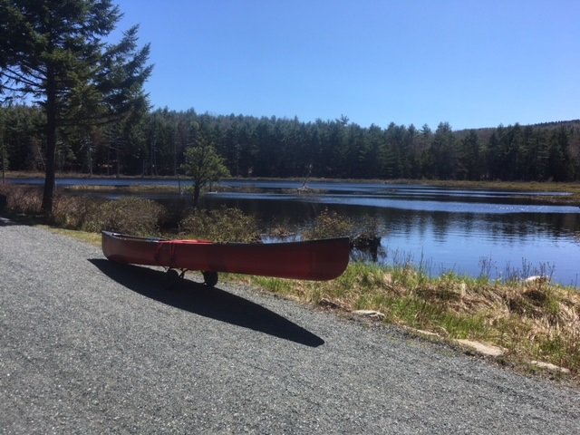
Witch Hole Pond can be shorefished for brook trout from multiple locations along the carriage road in early spring when the water is cool and the aquatic plant life subdued

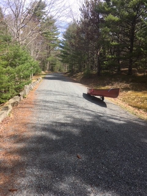
Witch Hole Pond covers 28 acres and is located in Acadia National Park on Mount Desert Island (MDI) in Hancock County, Maine (see The Maine Atlas and Gazetteer map 16 B4). I reach the pond by walking for about 1.5 miles on the 16 foot-wide and well-maintained carriage road from the small parking lot located off Route 233 across from Eagle Lake. Be aware that you’ll need a pass to legally park your car anywhere inside the Park, including here. The pass can be purchased on-line or at the Park’s main visitor center on MDI, among other places. I reached the Route 233 parking lot earlier this morning and have fished Lower Breakneck Pond, Upper Breakneck Pond, and Halfmoon Pond along the way. After hitting these three spots, I replace my canoe on my “canoe wheels” and continue on to my last destination for today. I’ll state here for the record that I should have returned to the Route 233 parking lot after fishing Halfmoon Pond, loaded up my gear in/on my car, driven to the Hulls Cove visitor Center, and then walked from there the half mile to Witch Hole Pond. The reason is that the carriage road drops by a surprisingly steep (but barely perceptible) 85 ft between Halfmoon Pond and Witch Hole Pond. That loss of elevation does not present any problems when going downhill with the canoe. However, it demands a strenuous – and very perceptible – effort to continuously push the canoe back uphill for half a mile! It takes me a solid 40 minutes of huffing and puffing (and several snack refueling stops) to make it back to the Route 233 parking lot at the end of the day.


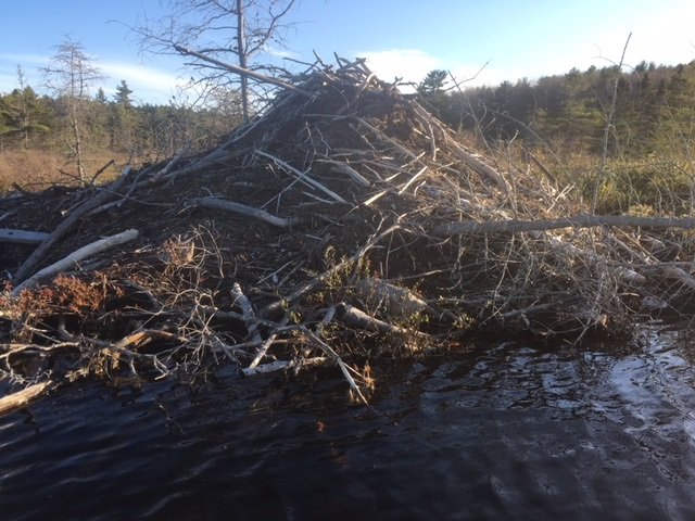
This big ol’ beaver lodge sits along the southern shore of Witch Hole Pond

Continue reading

Digiprove sealCopyright protected by Digiprove

Fishing for brook trout on Halfmoon Pond in Acadia National Park on Mount Desert Island, Maine (May 11, 2018)

View Map

View of Halfmoon Pond from the carriage road

Halfmoon Pond covers 3 acres and is located in Acadia National Park on Mount Desert Island (MDI) in Hancock County, Maine (see The Maine Atlas and Gazetteer map 16 B3). The pond can be reached by walking for about one mile on the 16 foot-wide and well-maintained carriage road. Leave your car in the small parking lot located off Route 233 across from Eagle Lake. Be aware that you’ll need a pass to legally park your car anywhere inside the Park, including here. The pass can be purchased on-line or at the Park’s major visitor center on MDI, among other places. I reach the parking lot at 9 am and head first to Lower Breakneck Pond and then to Upper Breakneck Pond. After fishing these two locations, I place my canoe on my “canoe wheels” and lug everything to my next destination.

Continue reading

Digiprove sealCopyright protected by Digiprove

Fishing for brook trout on Upper Breakneck Pond in Acadia National Park on Mount Desert Island, Maine (May 11, 2018)

View Map

The carriage road provides easy access to Upper Breakneck Pond


Upper Breakneck Pond covers 9 acres and is located in Acadia National Park on Mount Desert Island (MDI) in Hancock County, Maine (see The Maine Atlas and Gazetteer map 16 B3). The pond can be reached by walking for about 2,500 ft on the 16 foot-wide and well-maintained carriage road. Leave your car in the small parking lot located off Route 233 across from Eagle Lake. Be aware that you’ll need a pass to legally park your car anywhere inside the Park, including here. The pass can be purchased on-line or at the Park’s main visitor center on MDI, among other places. I reach the parking lot at 9 am and head first to Lower Breakneck Pond. I then carry my canoe through the 50 ft long outlet that connects the lower pond to the upper pond. Note, however, that Upper Breakneck Pond can also be reached directly from the carriage road via a short walk through the woods.

Continue reading

Digiprove sealCopyright protected by Digiprove

Fishing for brook trout on Lower Breakneck Pond in Acadia National Park on Mount Desert Island, Maine (May 11, 2018)

View Map


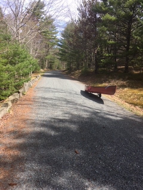
The carriage road is wide and accessible to everyone


Lower Breakneck Pond covers 8 acres and is located in Acadia National Park on Mount Desert Island (MDI) in Hancock County, Maine (see The Maine Atlas and Gazetteer map 16 B3). The pond can be reached by walking on the wide and well-maintained carriage road. Leave your car in the small parking lot off Route 233 across from Eagle Lake. Be aware that you’ll need a pass to legally park your car anywhere inside the Park, including here (even though the parking lot is right off a public road). The pass can be purchased on-line or at the Park’s visitor center on MDI, among other places. I reach the parking lot at 8:30 am and am glad to see only a few other vehicles. This relatively small lot fills up quickly later on in the season, particularly on weekends. I place my canoe on my “canoe wheels”, load it up with all my fishing gear, and walk the half mile or so towards the pond.


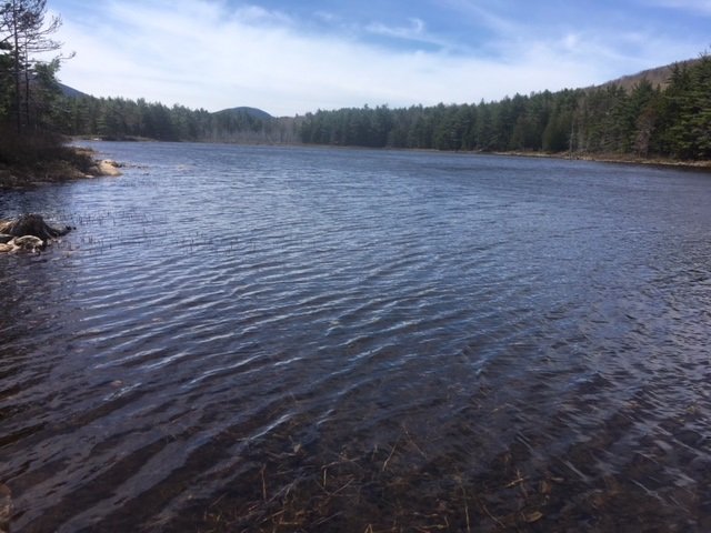
General view of Lower Breakneck Pond in early spring (no aquatic vegetation on the surface yet) looking south.


Continue reading

Digiprove sealCopyright protected by Digiprove

Fishing for brook trout on Bubble Pond in Acadia National Park on Mount Desert Island, Maine (May 12, 2018)

View Map

Bubble Pond covers 32 acres and is located inside Acadia National Park on Mount Desert Island (MDI) in Hancock County, Maine (see The Atlas and Gazetteer map 16 B4). The pond is situated right off the Park Loop Road. Vehicles can be parked in a small paved lot which contains a clean bathroom. Be aware that you’ll need a pass to legally park your car anywhere inside the Park. The pass can be purchased on-line or at the visitor center on MDI. The pond is located about 200 ft further down from the parking area. The access point can only accommodate hand-carried craft. Besides, it lacks an official launch and motor boats with internal combustion engines are prohibited.

Continue reading

Digiprove sealCopyright protected by Digiprove

Fishing for brook trout on Long Pond in Acadia National Park on Mount Desert Island, Maine (May 12, 2018)

View Map

Long Pond covers 897 acres and is located in Acadia National Park, just north of Southwest Harbor, on Mount Desert Island (MDI) in Hancock County, Maine (see The Maine Atlas and Gazetteer map 16 C2). This body of water is surrounded by Acadia National Park on its entire western side, and along the lower third on its eastern side. I access the pond via the public boat launch at the end of Long Pond Road at the southern tip of the pond. Even though this launch falls within the boundary of the Park, I do not see any signs which explicitly state that vehicles require a Park-issued pass to enter or to park a vehicle. I’m not worried because I have the pass. However, it might be prudent to first inquire with the Park authorities, just to make sure. The pass can be purchased on-line or at the Park’s visitor center on MDI, if needed. I also note that a second public boat launch is located at the northern tip of this pond right off Route 102 (Pretty Marsh Road; see The Maine Atlas and Gazetteer map 16 B2) which falls outside of the Park boundaries and therefore would not require a pass.

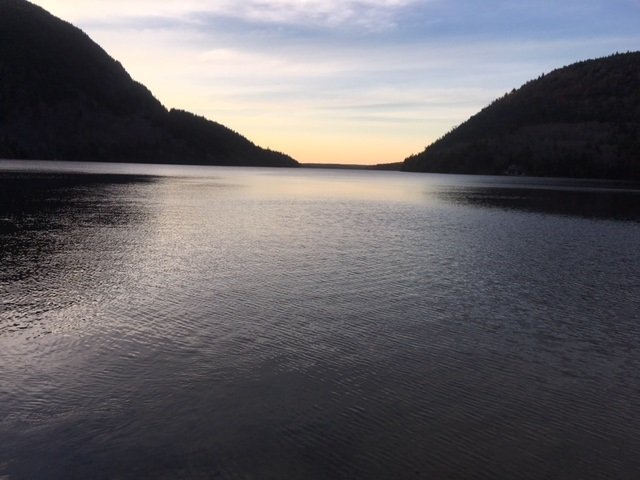
Sunset view of Long Pond from the boat launch at the southern tip of the lake.

Continue reading

Digiprove sealCopyright protected by Digiprove