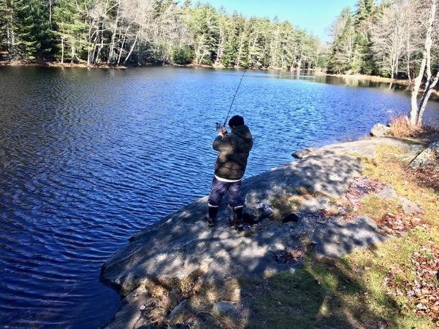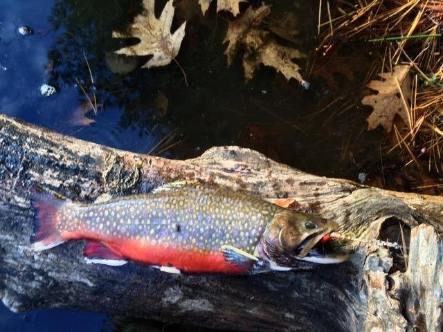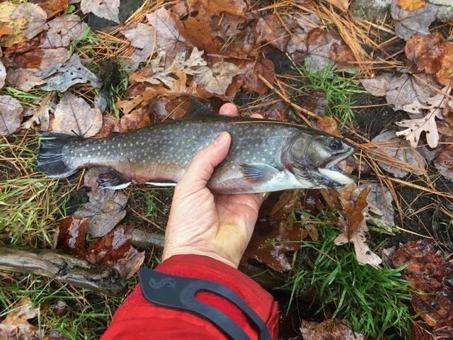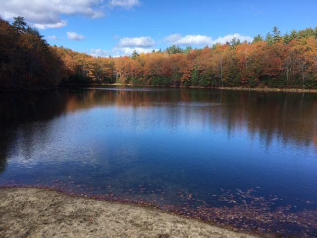
Fishing for brown trout and brook trout on Middle Range Pond, Poland, Maine (April 23, 2020)

View Map


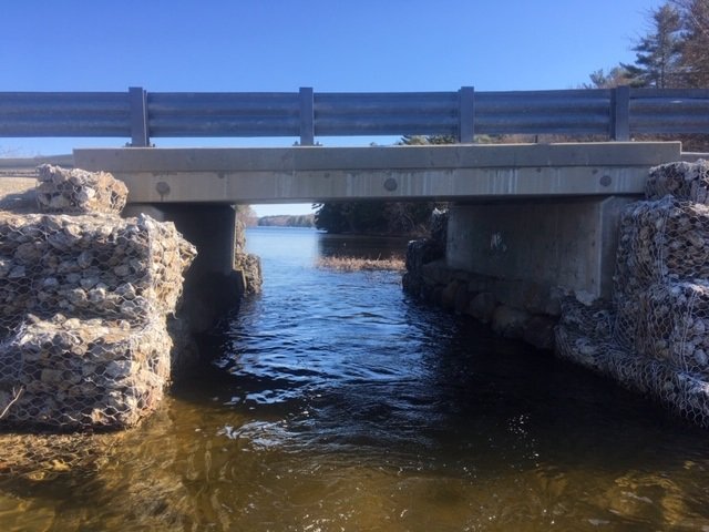
The passageway underneath Range Hill Road. Middle Range Pond is visible in the background.


Middle Range Pond is a 366-acre body of water located in Poland, Androscoggin County, Maine (see The Maine Atlas and Gazetteer map 5 A3). This pond is the second of the three interconnected Range Pond chain-of-lakes (i.e., upper, middle, and lower). The middle and upper ponds actually share a public boat launch which is located off Range Hill Road, at the downstream end of upper pond. A narrow passage underneath this road allows boats to access middle pond. Plenty of parking is available at the launch site. Note that the stretch of water between this passageway and Middle Range Pond extends for about a third of a mile, is really shallow (1-2 ft deep), and overgrown with aquatic vegetation later on in the season. It is actually a great spot for catching largemouth bass in May and June, but that is not why I’m here for today.

Continue reading

Digiprove sealCopyright protected by Digiprove

Ice fishing for brook trout on Kalers Pond in Waldoboro, Lincoln County, Maine (January 18, 2020)

View Map

Kalers Pond covers 87 acres and is located in Waldoboro, Lincoln County, Maine (see The Maine Atlas and Gazetteer map 13 E4). Drive east on Route 1 and turn left on Kalers Pond Road by the Dow Furniture store (look for the green store sign next to Route 1) about 1.5 miles before downtown Waldoboro. Note that Kalers Pond Road is privately owned, although it is not posted as such. Access to the pond is via permissive trespass over this road. I notice several hand-made signs pointing anglers in the direction of the access point. The road is unplowed past the last sign, which also requests that anglers park their vehicles at a plowed parking area across from the furniture store by Route 1. It takes less than 10 minutes to walk from the parking area by the store to the last sign, and another 2 minutes from this sign to the pond. I urge everyone to respect the wishes of the local property owners and follow the rules in order to keep access to this pond open and available to the general public far into the future.

Continue reading

Digiprove sealCopyright protected by Digiprove

Ice fishing for brook trout on Silver Lake in Phippsburg, Sagadahoc County, Maine (December 28, 2019)

View Map


The first trout of the morning is a real beauty!


Silver Lake covers 12 acres and is located next to the ocean in Phippsburg, Sagadahoc County, Maine (see The Maine Atlas and Gazetteer map 6 E5; note that the lake is shown on the map but is not specifically named). To reach this pond, drive on Route 209 from Bath towards Popham Beach State Park. Pass the state park entrance and drive for another 0.5 miles. Turn right on Hunnewell Avenue just before reaching the pond. You can park your vehicle on the left side about 200 ft further down that road. I do not know what the parking situation would be on Hunnewell Avenue after a snow storm when the road has been plowed and the narrow shoulder is filled with snow.

Continue reading

Digiprove sealCopyright protected by Digiprove

Ice fishing for brook trout on Chaffin Pond in Windham, Cumberland County, Maine (December 23, 2019)

View Map

Chaffin Pond is a pretty 13-acre body of water located in Windham, Maine (see The Maine Atlas and Gazetteer map 5 C2). Access is super-easy! Drive on Route 302 north into Windham, pass the Home Depot sign (Franklin Drive) and take the next right on Chaffin Pond Reserve Drive (Donnabeth Lippman Park) just before the Sherman Williams store. Our target is a couple of 100 ft down that ruddy dirt road. Ample parking is available. The pond and its surrounding woods once belonged to the Portland Water District which prevented any development (except for a few groundwater pump houses). The area is now a well-used municipal park where young and old come to picnic, walk the many trails, use the playground, or fish, literally smack in the middle of Windham’s busy business district!

Continue reading

Digiprove sealCopyright protected by Digiprove

Fishing for brook trout on Charles Pond, in Georgetown, Sagadahoc County, Maine (November 9, 2019)

View Map


Geovani casting in the basin at the outlet by the road. No easy pickings here today…


Charles Pond covers 14 acres and is located next to Route 127 (Five Islands Road) in Georgetown, Sagadahoc County, Maine (see The Maine Atlas and Gazetteer map 7 D1). This location has proven to be an excellent early ice-fishing destination for me in the past (click here and here for examples). The pond was stocked earlier this fall with 150 7” brookies (about 11 trout per acre) and 75 13” brookies (= about 5 trout per acre). I am eager to connect with those larger one-pounders this morning.

Continue reading

Digiprove sealCopyright protected by Digiprove

Fishing for brook trout on Otter Pond #2 in Standish, Cumberland County, Maine (November 7, 2019)


Those colors…!


Otter Pond #2 is a 12-acre body of water located off Route 35 in Standish, Cumberland, Maine (see The Maine Atlas and Gazetteer map 5 D1). Click here for directions on how to reach this pond. Her and I are old acquaintances, having met many times over the years in the spring, fall, and winter. This pond is heavily stocked with brook trout each fall in anticipation of the busy ice-fishing season. Earlier this fall, the state released 600 8” brookies (= 50 trout per acre) and 130 13” brookies (= 11 trout per acre), which add up to a lot of fish! Those bigger fish are the ones calling me in. It is high time that I pay a visit and check out the place before it starts freezing over.

Continue reading

Digiprove sealCopyright protected by Digiprove

Fishing for brook trout on Chaffin Pond in Windham, Cumberland County, Maine (November 1, 2019)

View Map


The first brookie of the morning. I’m on to something!


Chaffin Pond is a pretty 13-acre body of water located in Windham, Maine (see The Maine Atlas and Gazetteer map 5 C2). Access is super-easy! Drive on Route 302 north into Windham, pass the Home Depot sign (Franklin Drive) and take the next right on Chaffin Pond Reserve Drive (Donnabeth Lippman Park) just before the Sherman Williams store. Our target is a couple of 100 ft down that ruddy dirt road. Ample parking is available. The pond and its surrounding woods once belonged to the Portland Water District which prevented any development (except for a few groundwater pump houses). The area is now a well-used municipal park where young and old come to picnic, walk the many trails, use the playground, or fish, literally smack in the middle of Windham’s busy business district!

Continue reading

Digiprove sealCopyright protected by Digiprove

Fishing for brook trout on Otter Pond #4 in Standish, Cumberland County, Maine (October 26, 2019)

View Map


View of Otter Pond #4 from the beach. The best fishing is from the shore on the right-hand side of this picture.


Otter Pond #4, a.k.a. Snake Pond, is a 6-acre body of water located off Route 35 in Standish, Cumberland, Maine (see The Maine Atlas and Gazetteer map 5 D1). Click here for directions on how to reach this pond. My blog readers have asked me about locations in southern and central Maine that can be wader fished from shore in the fall without the need for a boat. This spot is one of many. We are actually old acquaintances, having met numerous times before (click here and here for examples). It is heavily stocked with brook trout each fall in anticipation of the busy ice-fishing season. Fortunately for us, this little gem is available for open-water fishing between October 1 and November 30 using artificial lures only and with the stipulation that all trout caught must be released at once.   Click here for more details on the fishing rules. Click here for a depth map.

Continue reading

Digiprove sealCopyright protected by Digiprove

Fishing for brook trout on Dixon Pond in Pierce Pond Township, Somerset County, Maine (May 28, 2019)

View Map


Pierce Pond Mountain plunges into Dixon Pond.


Dixon Pond is a picturesque 17-acre body of water located within the Pierce Pond Township in Somerset County, Maine (see The Maine Atlas and Gazetteer map 30 A1). It is sandwiched between Dixon Mountain and the eastern flank of mighty Pierce Pond Mountain. I access this pond via a poorly-marked 1-mile trail that starts at the water’s edge in the narrows separating lower from middle Pierce Pond. However, the Maine Atlas and Gazetteer shows that Dixon Pond can also be reached via a rough 2.5 to 3 mile logging road off Cobb’s Camp Road starting at Lindsey Cove in lower Pierce Pond. I haven’t used the latter and can’t tell how easy it would be to find the pond from that direction. What I can say is that the 1-mile trail I used on my expedition today was a total clusterf*ck on account of extensive clear-cutting in that part of the woods in the recent past, plus significant tree blow-downs during last winter’s storms. A half-hour stroll through the forest became a one hour ordeal of carefully working my way through mud pools, deep skitter gullies, fallen trees, root balls, and other obstacles, without getting lost along the way.

Continue reading

Digiprove sealCopyright protected by Digiprove

Fishing for brook trout on Broken Bridge Pond in Albany (White Mountain National Forest), Maine (June 9, 2019)

View Map


Broken Bridge Pond is an 18-acre body of water in the township of Albany (White Mountain National Forest, WMNF), Oxford County (see The Maine Atlas and Gazetteer map 10 C3). To reach this spot, drive down Route 5/35 and turn on Old West Bethel Road, followed by Patte Brook Road, and then Crocker Pond Road (through the open WMNF gate) for about 1.5-2 miles. A GPS will definitely help keep your bearings! Look out for a sign on the left side of Crocker Pond Road which announces a campsite on the shore of our target pond. The rough canoe launch is down an unmarked dirt road on the left about 500 ft before this campsite.
Continue reading

Digiprove sealCopyright protected by Digiprove