Fishing for brook trout on Halfmoon Pond in Acadia National Park on Mount Desert Island, Maine (May 11, 2018)

View Map

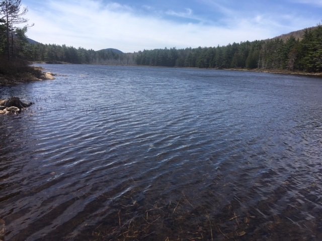
View of Halfmoon Pond from the carriage road

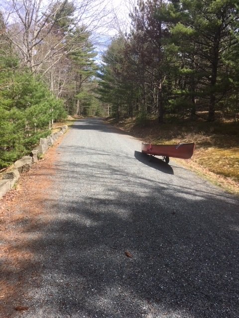
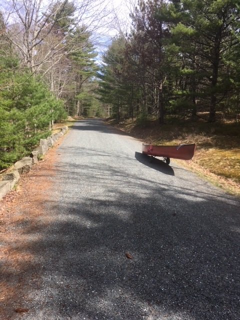
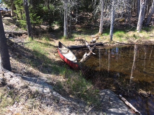
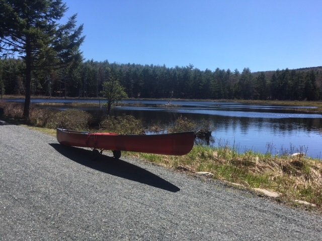
Halfmoon Pond covers 3 acres and is located in Acadia National Park on Mount Desert Island (MDI) in Hancock County, Maine (see The Maine Atlas and Gazetteer map 16 B3). The pond can be reached by walking for about one mile on the 16 foot-wide and well-maintained carriage road. Leave your car in the small parking lot located off Route 233 across from Eagle Lake. Be aware that you’ll need a pass to legally park your car anywhere inside the Park, including here. The pass can be purchased on-line or at the Park’s major visitor center on MDI, among other places. I reach the parking lot at 9 am and head first to Lower Breakneck Pond and then to Upper Breakneck Pond. After fishing these two locations, I place my canoe on my “canoe wheels” and lug everything to my next destination.

Continue reading

Digiprove sealCopyright protected by Digiprove
Fishing for brook trout on Upper Breakneck Pond in Acadia National Park on Mount Desert Island, Maine (May 11, 2018)

View Map

The carriage road provides easy access to Upper Breakneck Pond


Upper Breakneck Pond covers 9 acres and is located in Acadia National Park on Mount Desert Island (MDI) in Hancock County, Maine (see The Maine Atlas and Gazetteer map 16 B3). The pond can be reached by walking for about 2,500 ft on the 16 foot-wide and well-maintained carriage road. Leave your car in the small parking lot located off Route 233 across from Eagle Lake. Be aware that you’ll need a pass to legally park your car anywhere inside the Park, including here. The pass can be purchased on-line or at the Park’s main visitor center on MDI, among other places. I reach the parking lot at 9 am and head first to Lower Breakneck Pond. I then carry my canoe through the 50 ft long outlet that connects the lower pond to the upper pond. Note, however, that Upper Breakneck Pond can also be reached directly from the carriage road via a short walk through the woods.

Continue reading

Digiprove sealCopyright protected by Digiprove
Fishing for brook trout on Lower Breakneck Pond in Acadia National Park on Mount Desert Island, Maine (May 11, 2018)

View Map


The carriage road is wide and accessible to everyone


Lower Breakneck Pond covers 8 acres and is located in Acadia National Park on Mount Desert Island (MDI) in Hancock County, Maine (see The Maine Atlas and Gazetteer map 16 B3). The pond can be reached by walking on the wide and well-maintained carriage road. Leave your car in the small parking lot off Route 233 across from Eagle Lake. Be aware that you’ll need a pass to legally park your car anywhere inside the Park, including here (even though the parking lot is right off a public road). The pass can be purchased on-line or at the Park’s visitor center on MDI, among other places. I reach the parking lot at 8:30 am and am glad to see only a few other vehicles. This relatively small lot fills up quickly later on in the season, particularly on weekends. I place my canoe on my “canoe wheels”, load it up with all my fishing gear, and walk the half mile or so towards the pond.


General view of Lower Breakneck Pond in early spring (no aquatic vegetation on the surface yet) looking south.


Continue reading

Digiprove sealCopyright protected by Digiprove

Fishing for brook trout on Bubble Pond in Acadia National Park on Mount Desert Island, Maine (May 12, 2018)

View Map

Bubble Pond covers 32 acres and is located inside Acadia National Park on Mount Desert Island (MDI) in Hancock County, Maine (see The Atlas and Gazetteer map 16 B4). The pond is situated right off the Park Loop Road. Vehicles can be parked in a small paved lot which contains a clean bathroom. Be aware that you’ll need a pass to legally park your car anywhere inside the Park. The pass can be purchased on-line or at the visitor center on MDI. The pond is located about 200 ft further down from the parking area. The access point can only accommodate hand-carried craft. Besides, it lacks an official launch and motor boats with internal combustion engines are prohibited.

Continue reading

Digiprove sealCopyright protected by Digiprove

Fishing for brook trout on Long Pond in Acadia National Park on Mount Desert Island, Maine (May 12, 2018)

View Map

Long Pond covers 897 acres and is located in Acadia National Park, just north of Southwest Harbor, on Mount Desert Island (MDI) in Hancock County, Maine (see The Maine Atlas and Gazetteer map 16 C2). This body of water is surrounded by Acadia National Park on its entire western side, and along the lower third on its eastern side. I access the pond via the public boat launch at the end of Long Pond Road at the southern tip of the pond. Even though this launch falls within the boundary of the Park, I do not see any signs which explicitly state that vehicles require a Park-issued pass to enter or to park a vehicle. I’m not worried because I have the pass. However, it might be prudent to first inquire with the Park authorities, just to make sure. The pass can be purchased on-line or at the Park’s visitor center on MDI, if needed. I also note that a second public boat launch is located at the northern tip of this pond right off Route 102 (Pretty Marsh Road; see The Maine Atlas and Gazetteer map 16 B2) which falls outside of the Park boundaries and therefore would not require a pass.

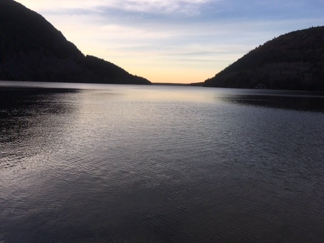
Sunset view of Long Pond from the boat launch at the southern tip of the lake.

Continue reading

Digiprove sealCopyright protected by Digiprove

Fishing for brook trout on Round Pond in Acadia National Park on Mount Desert Island, Maine (May 13, 2018)

View Map

The launch area next to Route 102 is rough and can only accommodate hand-carried craft.

Round Pond covers 38 acres and is located on Mount Desert Island (MDI) in Hancock County, Maine (see The Maine Atlas and Gazetteer map 16 B2). The western shoreline abuts Acadia National Park, whereas the eastern shoreline is privately owned as indicated by the presence of a handful of houses. The pond, which is located right off Pretty Marsh Road (Route 102) on the western half of MDI, is not in the Park itself. The pond can only be accessed from Route 102 via a short rough path and lacks a boat launch. Hence, it can only be fished using hand-carried craft. Keep in mind that no actual parking is available on Route 102 either. The road shoulder is sandy and narrow, and can safely accommodate only a few cars

Continue reading

Digiprove sealCopyright protected by Digiprove

Fishing for landlocked Atlantic salmon on Jordan Pond in Acadia National Park on Mount Desert Island, Maine (May 12, 2018)

View Map

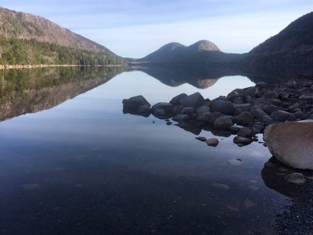
A gorgeous view of Jordan Pond from the boat launch

Jordan Pond covers 187 acres and is located inside Acadia National Park on Mount Desert Island (MDI) in Hancock County, Maine (see The Atlas and Gazetteer map 16 C3). The pond is situated off the Park Loop Road. A huge parking lot with a clean bathroom is located at the southern tip of the pond to accommodate the many visitors who come to this spot to hike the multiple trails that criss-cross the area. Access to the pond is via a rough unimproved boat launch. Be aware that you’ll need a pass to legally park your car anywhere inside the Park. The pass can be purchased on-line or at the visitor center on MDI.

Continue reading

Digiprove sealCopyright protected by Digiprove

Ice fishing for smallmouth bass and splake on Trickey Pond in Naples, Maine (March 31, 2018)

View Map

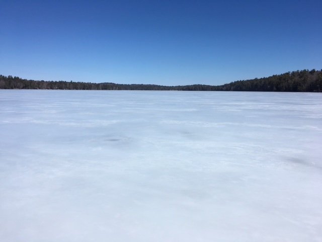
A bright and sunny, but windy, early-spring day on Trickey Pond

Trickey Pond covers 311 acres and is located in Naples, Cumberland County, Maine (see The Maine Atlas and Gazetteer map 4 B5). I have fished it on multiple occasions in the past for smallmouth bass and splake. I also know from several reliable sources that this relatively small body of water grows serious landlocked Atlantic salmon in the 6- to 8-pound range! The reason I like to visit Trickey Pond towards the end of the ice fishing season is that its ice is always thick and safe, even when the hard water on other ponds in southern Maine is no longer reliable. Besides, there’s always the chance of catching a real bragging fish here! Keep in mind though that this pond has a well-deserved reputation of only grudgingly offering up its scaly denizens. So, be ready to put in time to learn its secrets if you are unfamiliar with its layout.


Continue reading

Digiprove sealCopyright protected by Digiprove

Ice fishing for brown trout on Pettingill Pond in Windham, Maine (February 10, 2018)

View Map

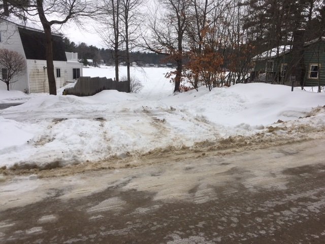
The public access point to Pettingill Pond is unobstrusive and unmarked.

Pettingill Pond covers 42 acres and is located in Windham, Cumberland County, Maine (see The Maine Atlas and Gazetteer map 5 C2). The public access to this body of water can be tricky to find under the snow in the winter. While driving on Route 302 in Windham (direction Raymond and Naples, i.e., north), turn right on Anglers Road at the traffic light just past Bob’s Seafood Restaurant. Go down that road for 0.4 miles and look for house number 48. The access point will be to your left immediately past that house (and across from house #51). It is not indicated by any signs. You have gone too far if you reach Mud Pond Road. Note that the local homeowners frown on people parking their vehicles on Anglers Road, which is quite narrow, twisty, and busy. You can either leave your vehicle by the public access point itself (it will accommodate two or three cars, but no more) or park it on a large plowed area located about 0.1 mile on Anglers Road after the turn-off from Route 302. Note that it may be a problem to pull a sled to the public access point for 0.3 miles if all the snow has been cleared from Anglers Road. I also suspect that this latter parking location may not be available for much longer because I saw a “for sale” sign next to it on my way in this morning.


Continue reading

Digiprove sealCopyright protected by Digiprove

Ice fishing for brook trout on Silver Lake in Phippsburg, Maine (January 13, 2018)

View Map

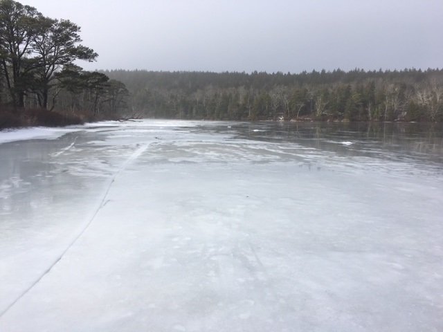
General View of Silver Lake. Note the gloomy sky and the glare ice.

Silver Lake covers 12 acres and is located in Phippsburg, Sagadahoc County, Maine (see The Maine Atlas and Gazetteer map 6 E5; note that the lake is shown on the map but is not specifically named). To reach this pond, drive on Route 209 from Bath towards Popham Beach State Park. Pass the state park entrance and drive for another 0.5 miles. The pond will be visible on your right from the road. Keep in mind that parking in this general area is tricky. I found no place to leave a vehicle behind on Route 209 across from the pond. Instead, your best option is to turn right on Hunnewell Avenue just before reaching the pond. A vehicle could be parked at that split, or further down that road. I do not know what the parking situation would be on Hunnewell Avenue after a snow storm. We’ve had several warm days before today so that a lot of snow has melted, allowing me to park tight against the remaining snow banks without obstructing local traffic.


Continue reading

Digiprove sealCopyright protected by Digiprove