Eight easy steps to sow a baitfish

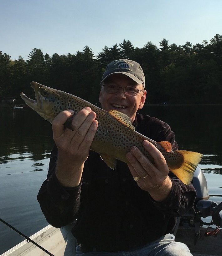
Your blog author with a nice brown trout caught at the end of the summer on a sown smelt

Trolling with sown bait is a time-honored Maine tradition for catching salmonids. This highly-effective approach can be used with both fresh bait or dead preserved (e.g., frozen, salted, pickled) bait.


Live bait, and smelt in particular, are difficult or impossible to find at your local bait dealer in the summer. The alternative when trolling for salmonids in the summer, therefore, is to use either dead baitfish or lures (e.g., spoons or streamer flies). A dead sown baitfish, if prepared as described in this blog, will provide a much more realistic profile than an artificial lure. Don’t get me wrong here: I’m not implying that artificials don’t work, far from it. After all, I’ve caught way too many salmon and trout trolling with spoons and streamer flies over the years. What I am saying though is that a baitfish, even dead, is more natural-looking than an artificial lure and therefore increases the odds of catching the fish we so desire. I suspect the major reason that the Maine fishing rules only allow for artificial lures when fishing for salmonids in ponds and lakes in southern Maine after October 1 when those fish are getting ready to spawn is because the real thing is so much better at fooling them than artificial lures.


Personally, I prefer using a sliding minnow rig if my baitfish is alive. The reason is that a live baitfish will remain alive for a long time on the sliding minnow rig, and will therefore really look and swim like the real thing down below. On the other hand, one just can’t sow a live baitfish as described below and expect it to stay alive for long! So, my preference is to use the sliding minnow rig with live bait and the sowing technique with the stiffer dead bait.


Finally, over half a dozen different techniques have been developed to sow a baitfish. Each one gets to the end results slightly differently. The approach I discuss below was taught to me by a Maine old-timer. I find it quick and extremely easy to implement, and simple to teach. So, here it goes.

Continue reading

Digiprove sealCopyright protected by Digiprove
Fishing for brown trout on Sand Pond in Litchfield, Maine (September 22, 2018)

View Map

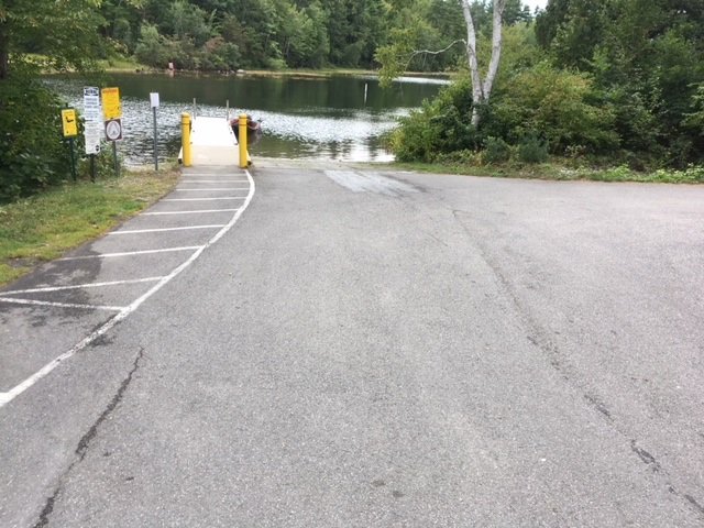
The boat launch on Woodbury Pond is spacious and can accommodate big boats.


Sand Pond covers 177 acres and is located in Litchfield, Kennebec County, Maine (see The Maine Atlas and Gazetteer map 12 D3). This pond does not have its own hard-top public boat launch. The closest one is located at the northern end of Woodbury Pond, which is connected to Sand Pond via a wide underpass over which runs Routes 9 and 126. That public access point can be reached as follows: while driving north on Hallowell Road, turn left on Hardscrabble Road and make an immediate left on Whippoorwill Road. Drive 0.3 miles on this road until you see the blue public access sign to your left. The boat launch is clean, spacious and well-maintained. It provides plenty of parking and also access to a convenient porta potty.
Continue reading

Digiprove sealCopyright protected by Digiprove
Fishing for brown trout on Horne Pond in Limington, Maine (September 16, 2018)

View Map

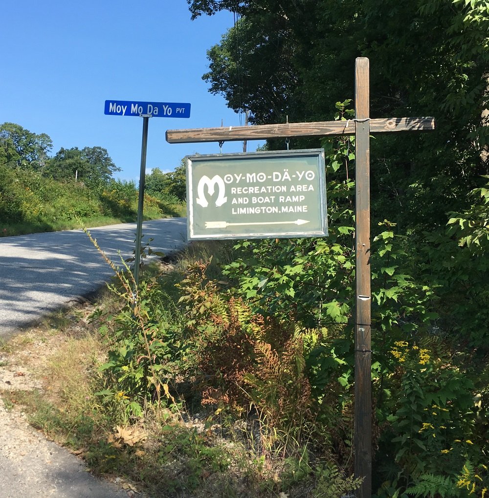
The sign to the boat launch on Horne Pond is clearly marked at the entrance by North Road

Horne Pond (a.k.a Pequawket Lake) covers 166 acres and is located in Limington, York County, Maine (see The Maine Atlas and Gazetteer map 4 D4). The public boat launch can be reached by turning onto Moy Mo Da Yo Road (I swear I didn’t make that name up!), which is the first dirt road on the right side of North Road about 400 ft after you turn onto it from Route 25. The turn-off on North Road is clearly indicated by a large green sign. Drive for another half a mile or so on this dirt road and follow the directions for the boat launch. The launch is hard-topped and can accommodate substantial boats. Ample parking is available nearby.
Continue reading

Digiprove sealCopyright protected by Digiprove

Fishing for brown trout on Hancock Pond in Denmark, Maine (September 15, 2018)

View Map

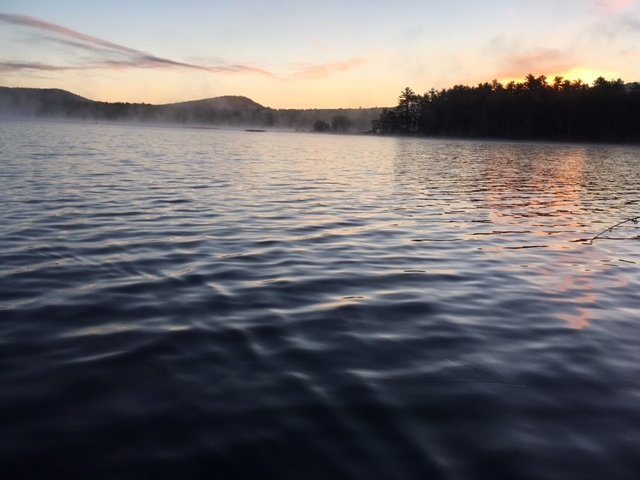
The morning fog is lifting as the sun is about to emerge over Hancock Pond

Hancock Pond covers 858 acres and straddles the boundary between the towns of Sebago and Denmark in Cumberland County and Oxford County, respectively (see The Atlas and Gazetteer map 4 B3 and 4). The public access is located along the eastern shoreline at the intersection of Hancock Pond Road and Wabunaki Road. The boat launch is hard-topped and can accommodate large motorized craft. Ample parking is available on Hancock Pond Road behind the large white electrical switch boxes across from the entrance to the launch. This pond, one of many in southern Maine which are stocked annually with brown trout, is known to grow some serious fish. Click here for a depth map and more fisheries information. I have it on good authority that 6++ pound brown trout behemoths swim around this body of water… This species is hardier than our native brook trout and also does better in the presence of other competing fish species, which is why browns are stocked in “marginal” brook trout waters. However, they are weary creatures and are less likely than brookies to grab artificial lures like spoons. I take advantage of the fact that I can still use live bait before the seasonal rule change on October 1, when only artificial lures are allowed in southern Maine.
Continue reading

Digiprove sealCopyright protected by Digiprove

Fishing for landlocked Atlantic salmon on Pierce Pond in Somerset County, Maine (May 28, 2018)

View Map

It’s the long Memorial Day weekend of 2018 and that means that I’m on my annual pilgrimage to gorgeous Pierce Pond in Somerset County, Maine (see The Maine Atlas and Gazetteer map 30 A2). This huge “pond” is divided into three major basins (i.e., Upper Pond, Middle Pond and Lower Pond) which together cover a total of 1,650 acres. I’m fishing for four days in this special place with my sons Joel and Jon, and nephew Salvy. We’re renting a cozy log cabin at Cobb’s Camp in Lower Pond which affords us access to an indoor toilet, a hot shower, and cooked meals off the grid in the middle of nowhere!  Pierce Pond is a totally pristine and unspoiled environment. The lake is completely surrounded by forests in a protected watershed. These conditions maintain the exceptional surface water quality which supports a robust and self-sustaining native brook trout population and a healthy population of stocked landlocked Atlantic salmon. The latter range in weight from 2 to 4 pounds. General fishing laws apply, except that (a) the pond is closed to ice fishing, (b) the pond opens to fishing on May 1 (but beware that ice-out can occur well past May 1 after a cold winter), (c) only artificial lures are allowed, (d) the daily bag limit for brook trout is two fish, and (e) the minimum length limit for brook trout is 10”, with only one fish allowed to exceed 12”. Click here for a depth map and click here for the fishing rules.


Continue reading

Digiprove sealCopyright protected by Digiprove

Fishing for brook trout on Witch Hole Pond in Acadia National Park on Mount Desert Island, Maine (May 11, 2018)

View Map

Witch Hole Pond can be shorefished for brook trout from multiple locations along the carriage road in early spring when the water is cool and the aquatic plant life subdued

Witch Hole Pond covers 28 acres and is located in Acadia National Park on Mount Desert Island (MDI) in Hancock County, Maine (see The Maine Atlas and Gazetteer map 16 B4). I reach the pond by walking for about 1.5 miles on the 16 foot-wide and well-maintained carriage road from the small parking lot located off Route 233 across from Eagle Lake. Be aware that you’ll need a pass to legally park your car anywhere inside the Park, including here. The pass can be purchased on-line or at the Park’s main visitor center on MDI, among other places. I reached the Route 233 parking lot earlier this morning and have fished Lower Breakneck Pond, Upper Breakneck Pond, and Halfmoon Pond along the way. After hitting these three spots, I replace my canoe on my “canoe wheels” and continue on to my last destination for today. I’ll state here for the record that I should have returned to the Route 233 parking lot after fishing Halfmoon Pond, loaded up my gear in/on my car, driven to the Hulls Cove visitor Center, and then walked from there the half mile to Witch Hole Pond. The reason is that the carriage road drops by a surprisingly steep (but barely perceptible) 85 ft between Halfmoon Pond and Witch Hole Pond. That loss of elevation does not present any problems when going downhill with the canoe. However, it demands a strenuous – and very perceptible – effort to continuously push the canoe back uphill for half a mile! It takes me a solid 40 minutes of huffing and puffing (and several snack refueling stops) to make it back to the Route 233 parking lot at the end of the day.


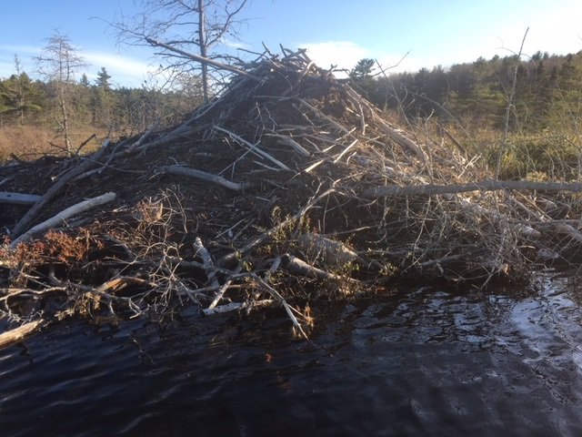
This big ol’ beaver lodge sits along the southern shore of Witch Hole Pond

Continue reading

Digiprove sealCopyright protected by Digiprove

Fishing for brook trout on Halfmoon Pond in Acadia National Park on Mount Desert Island, Maine (May 11, 2018)

View Map

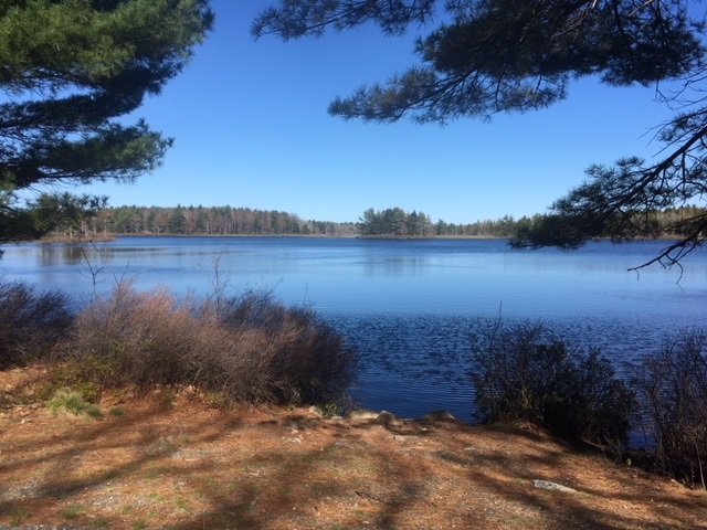
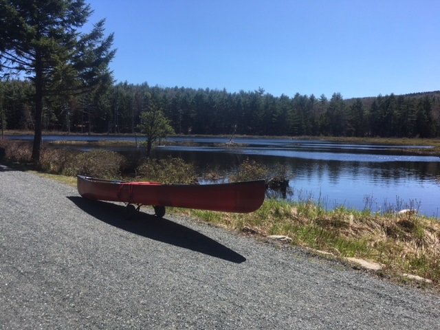
View of Halfmoon Pond from the carriage road

Halfmoon Pond covers 3 acres and is located in Acadia National Park on Mount Desert Island (MDI) in Hancock County, Maine (see The Maine Atlas and Gazetteer map 16 B3). The pond can be reached by walking for about one mile on the 16 foot-wide and well-maintained carriage road. Leave your car in the small parking lot located off Route 233 across from Eagle Lake. Be aware that you’ll need a pass to legally park your car anywhere inside the Park, including here. The pass can be purchased on-line or at the Park’s major visitor center on MDI, among other places. I reach the parking lot at 9 am and head first to Lower Breakneck Pond and then to Upper Breakneck Pond. After fishing these two locations, I place my canoe on my “canoe wheels” and lug everything to my next destination.

Continue reading

Digiprove sealCopyright protected by Digiprove

Fishing for brook trout on Upper Breakneck Pond in Acadia National Park on Mount Desert Island, Maine (May 11, 2018)

View Map

The carriage road provides easy access to Upper Breakneck Pond


Upper Breakneck Pond covers 9 acres and is located in Acadia National Park on Mount Desert Island (MDI) in Hancock County, Maine (see The Maine Atlas and Gazetteer map 16 B3). The pond can be reached by walking for about 2,500 ft on the 16 foot-wide and well-maintained carriage road. Leave your car in the small parking lot located off Route 233 across from Eagle Lake. Be aware that you’ll need a pass to legally park your car anywhere inside the Park, including here. The pass can be purchased on-line or at the Park’s main visitor center on MDI, among other places. I reach the parking lot at 9 am and head first to Lower Breakneck Pond. I then carry my canoe through the 50 ft long outlet that connects the lower pond to the upper pond. Note, however, that Upper Breakneck Pond can also be reached directly from the carriage road via a short walk through the woods.

Continue reading

Digiprove sealCopyright protected by Digiprove

Fishing for brook trout on Lower Breakneck Pond in Acadia National Park on Mount Desert Island, Maine (May 11, 2018)

View Map


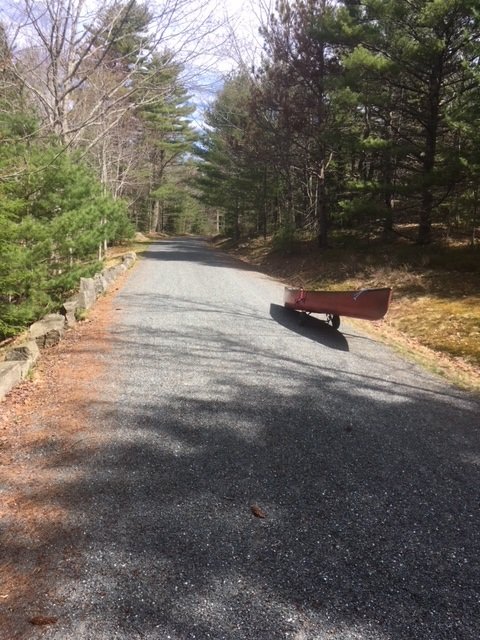
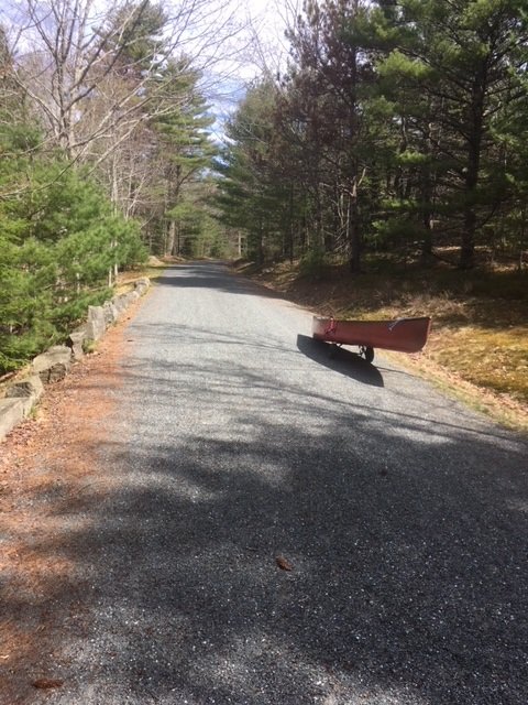
The carriage road is wide and accessible to everyone


Lower Breakneck Pond covers 8 acres and is located in Acadia National Park on Mount Desert Island (MDI) in Hancock County, Maine (see The Maine Atlas and Gazetteer map 16 B3). The pond can be reached by walking on the wide and well-maintained carriage road. Leave your car in the small parking lot off Route 233 across from Eagle Lake. Be aware that you’ll need a pass to legally park your car anywhere inside the Park, including here (even though the parking lot is right off a public road). The pass can be purchased on-line or at the Park’s visitor center on MDI, among other places. I reach the parking lot at 8:30 am and am glad to see only a few other vehicles. This relatively small lot fills up quickly later on in the season, particularly on weekends. I place my canoe on my “canoe wheels”, load it up with all my fishing gear, and walk the half mile or so towards the pond.


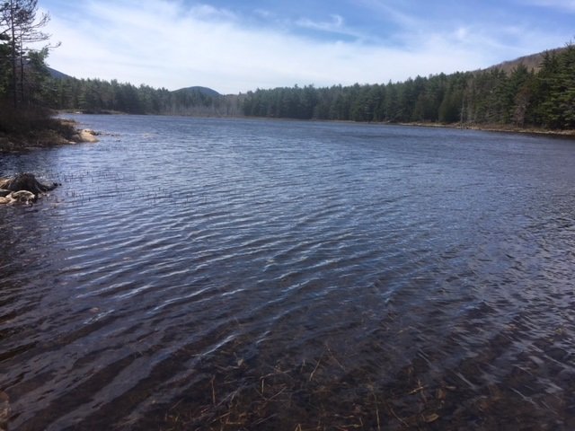
General view of Lower Breakneck Pond in early spring (no aquatic vegetation on the surface yet) looking south.


Continue reading

Digiprove sealCopyright protected by Digiprove

Fishing for brook trout on Bubble Pond in Acadia National Park on Mount Desert Island, Maine (May 12, 2018)

View Map

Bubble Pond covers 32 acres and is located inside Acadia National Park on Mount Desert Island (MDI) in Hancock County, Maine (see The Atlas and Gazetteer map 16 B4). The pond is situated right off the Park Loop Road. Vehicles can be parked in a small paved lot which contains a clean bathroom. Be aware that you’ll need a pass to legally park your car anywhere inside the Park. The pass can be purchased on-line or at the visitor center on MDI. The pond is located about 200 ft further down from the parking area. The access point can only accommodate hand-carried craft. Besides, it lacks an official launch and motor boats with internal combustion engines are prohibited.

Continue reading

Digiprove sealCopyright protected by Digiprove