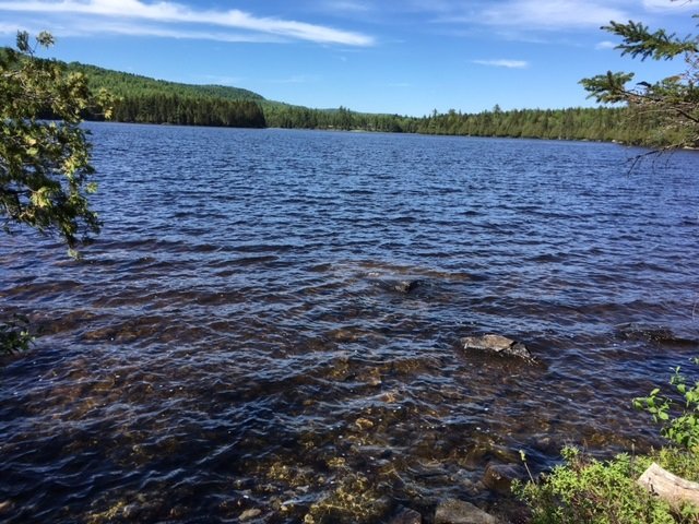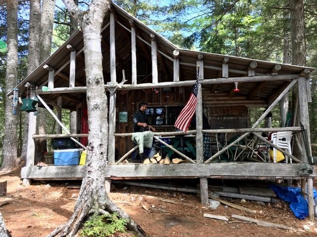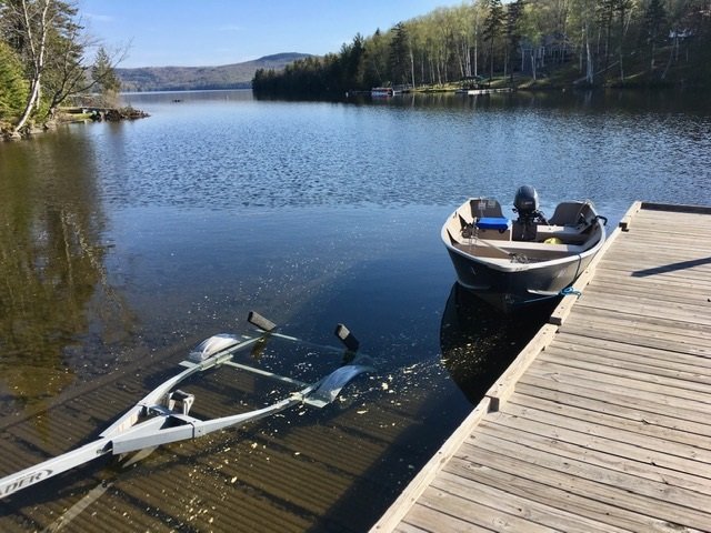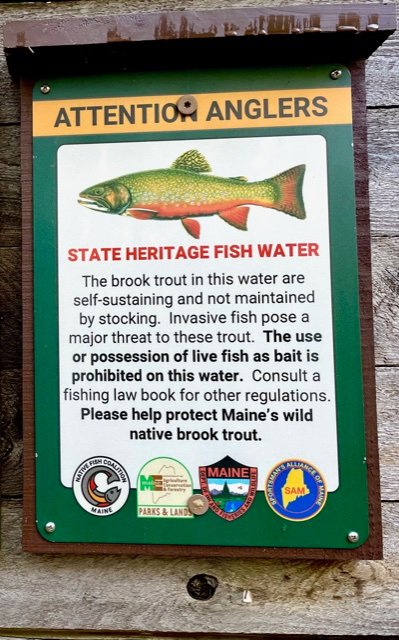
Fishing for brook trout on Upper Pond, Deboullie Maine Public Reserved Land, Aroostook County, Maine (September 28, 2021)


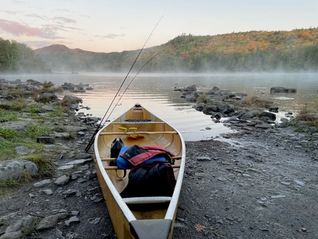
Upper Pond has special regulations to protect its self-sustaining brook trout population


Upper Pond is a pretty 17-acre body of water located in the Deboullie Maine Public Reserved Land (T15 R9 WELS) in northern Aroostook County (see The Maine Atlas and Gazetteer map 63 A1). This township is situated about 27 driving miles northwest of the village of Portage (by Portage Lake), and 10 to 15 miles as the crow flies due east of the Allagash River Waterway. Access is via a series of well-maintained gravel logging roads. I was concerned about getting lost on this extensive network of roads but found excellent driving directions for Red River Camps which is located in the middle of the Public Reserved Land. It also helps that the directions are indicated by brown “RRC” (Red River Camps) and blue “State of Maine Public Reserved Land” signs. Finally, be aware that the T15 R9 WELS township is located in the North Maine Woods. Access (coming from the south) to this region is via the Fish River Checkpoint where one must stop to obtain an entry permit and pay a nominal day-use fee and overnight camping fee. Numerous campsites are available within the Deboullie township. Come prepared to be self-sufficient because the closest store is at Portage.


Continue reading

Digiprove sealCopyright protected by Digiprove
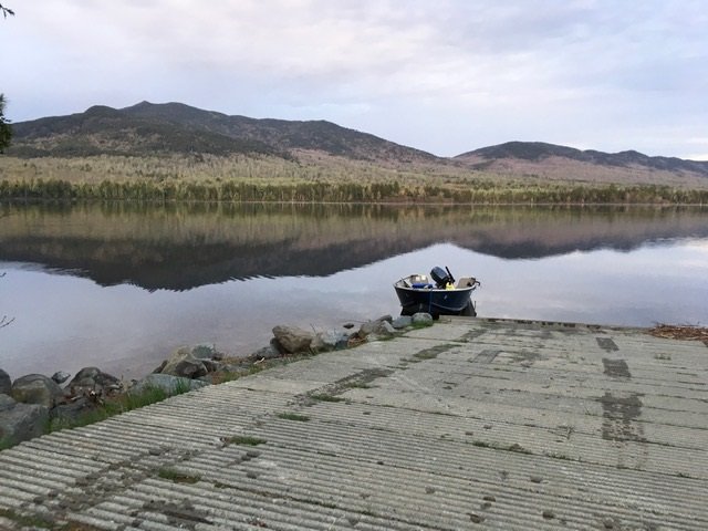
Fishing for brook trout on Deboullie Pond, Deboullie Maine Public Reserved Land, Aroostook County, Maine (September 28, 2021)


What a beautiful way to start my morning troll!


Deboullie Pond is a gorgeous 262-acre body of water located in the Deboullie Maine Public Reserved Land (T15 R9 WELS) in northern Aroostook County (see The Maine Atlas and Gazetteer map 63 A1). This township is located about 27 driving miles northwest of the village of Portage (by Portage Lake), and 10-15 miles as the crow flies due east of the Allagash River. Access is via a series of well-maintained gravel logging roads. I was concerned about getting lost on this extensive network of roads but found excellent driving directions for Red River Camps which is located in the middle of the Public Reserved Land. It also helps that the directions are indicated by brown “RRC” (Red River Camps) and blue “State of Maine Public Reserved Land” signs. Finally, be aware that the T15 R9 WELS township is located in the North Maine Woods. Access (coming from the south) to this region is via the Fish River Checkpoint where one must stop to obtain an entry permit and pay a nominal day-use fee and overnight camping fee. Over a dozen campsites are available within the Deboullie township. Come prepared to be self-sufficient because the closest store is in Portage…

Continue reading

Digiprove sealCopyright protected by Digiprove

Fishing for rainbow trout on Little Sebago Lake in Windham and Gray, Cumberland County, Maine (August 1, 2021)


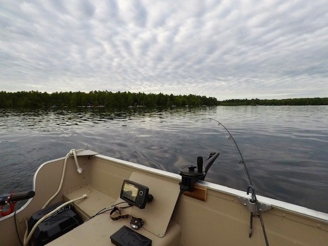
Ideal summer trolling conditions: early morning, wind still, low cloud deck, and no traffic!


Little Sebago Lake covers 1,898 acres and is located in Windham and Gray, Cumberland County, Maine (see The Maine Atlas and Gazetteer map 5 C2). To reach the public boat launch, drive north through downtown Windham on Route 302 (Roosevelt Trail) in the direction of Raymond, turn right on Anglers Way at the light by Bob’s Seafood restaurant and Franco’s Bistro, drive past Pettingill Pond, and just follow the blue boat launch signs. The distance between Route 302 and your destination is exactly 1.3 miles. The hard-top boat launch is spacious and has plenty of parking. It also offers a convenient porta potty.


Continue reading

Digiprove sealCopyright protected by Digiprove

Fishing for brown trout on Little Sebago Lake in Windham and Grey, Cumberland County, Maine (July 26, 2021)


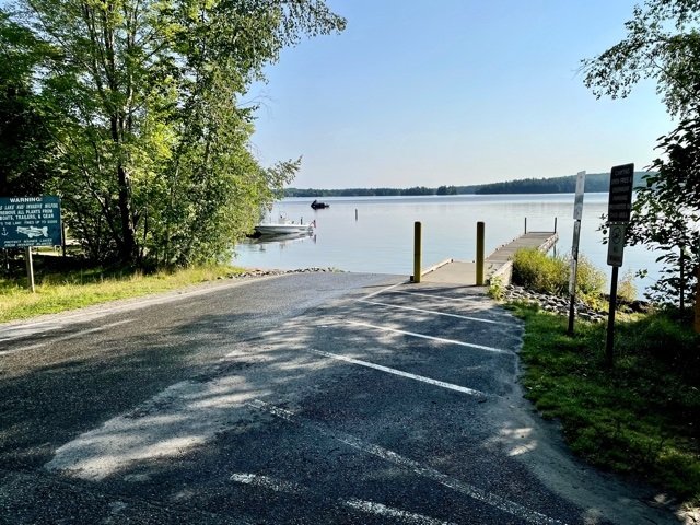
The public boat launch is spacious and offers plenty of parking.


Little Sebago Lake covers 1,898 acres and is located in Windham and Gray, Cumberland County, Maine (see The Maine Atlas and Gazetteer map 5 C2). To reach the public boat launch, drive north through downtown Windham on Route 302 (Roosevelt Trail) in the direction of Raymond. Turn right on Anglers Way at the light by Bob’s Seafood restaurant and Franco’s Bistro, drive past Pettingill Pond and just follow the blue boat launch signs. The distance between Route 302 and your destination is exactly 1.3 miles. The hard-top boat launch is spacious and has plenty of parking. It also offers a convenient porta potty.


Continue reading

Digiprove sealCopyright protected by Digiprove

Fishing for brook trout in Washburn Pond in Woodstock, Oxford County, Maine (June 19, 2021)


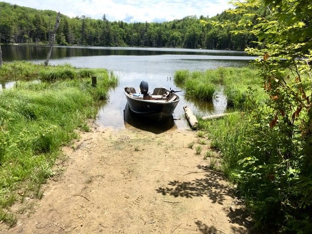
The boat launch is narrow and rather shallow.


Washburn Pond covers 12 acres and is located in Woodstock Township in Oxford County, Maine (see The Maine Atlas and Gazetteer map 11 A1). To reach this pond going north, drive down Redding Road and turn right on Washburn Pond Road right before reaching Sagg Pond. This 0.3 mile-long dirt road ends at Washburn Pond. Although it is rough in spots, the road will accommodate two-wheel drive cars. The pond has an unimproved and rather shallow sandy boat launch. I had to back my trailer about 30 ft. into the water before my boat would finally float off. The launch is also hemmed in by emergent aquatic vegetation on both sides. Hence, space is lacking to park the boat on shore AND back the trailer into the water at the same time. I was glad I brought my hip boots so I could place my boat in the vegetation to the side, back my trailer into the water, and then float the boat onto the trailer.


Continue reading

Digiprove sealCopyright protected by Digiprove

Fishing for brook trout in North Otter Pond in Bowtown Township, Somerset County, Maine (May 28, 2021)


View of North Otter Pond from the public access point


North Otter Pond covers 71 acres and is located in Bowtown Township in Somerset County, Maine (see The Maine Atlas and Gazetteer map 30 A2). This pond can be reached as follows: from North New Portland (see The Maine Atlas and Gazetteer map 30 E2), drive north on Long Falls Dam Road for about 23 miles and turn right on Carrying Place Road at the sign for Cobb’s Camps. Drive down this gravel road for 10.1 miles until the Yield traffic sign and turn left on Bowtown Road (note: Google Maps calls this road “Otter Pond Road”). Pass Harrison Camp on the left, cross Pierce Pond Stream and drive for another 3 miles or so. Turn left on a short dirt road which dead-ends in the woods. The pond and its unofficial public access point are visible through the trees. Both Carrying Place Road and Bowtown Road are gravel logging roads which are drivable by regular cars but can be rough during mud season in early spring. It took us about one hour to cover the 15 miles or so from the turn-off on Long Falls Dam Road to the pond. Hence, this pond is reachable by car even though it is rather remote. A boat launch is not available and only hand-carried craft can be placed in the water from the rough access point at the southern tip of the pond.


Continue reading

Digiprove sealCopyright protected by Digiprove

Fishing for landlocked Atlantic salmon on Pierce Pond in Pierce Pond Township, Somerset County, Maine (May 28, 2021)


Cabin life at Pierce Pond. The way life should truly be!


I’m on my annual extended Memorial Day weekend fishing pilgrimage to Pierce Pond located in Somerset County, Maine (see The Maine Atlas and Gazetteer map 30 A2). Click here for a more detailed description of this water body. Six of us have gathered to spend a week together at Cobb’s Camp to recharge our internal batteries, reconnect with each other, fish our hearts out, and make life-long memories.


Continue reading

Digiprove sealCopyright protected by Digiprove

Fishing for lake trout on Lower Wilson Pond in Greenville, Piscataquis County, Maine (May 17, 2021)


The boat launch by the dam is spacious.


Lower Wilson Pond is a 1,380-acre body of water located just east of the municipal airport in Greenville, Piscataquis County, Maine (see The Maine Atlas and Gazetteer map 41 D3). This lake has two public boat launches. I use the one at the southern tip by the dam off E Road (note: E Road is renamed the Katahdin Iron Works Road a mile or two further east). The hard-top launch is spacious, can accommodate large boats, and offers plenty of parking. The entrance to the launch is clearly marked by a large sign on E Road.


Continue reading

Digiprove sealCopyright protected by Digiprove

Fishing for brook trout on Shadow Pond in Greenville, Piscataquis County, Maine (May 16, 2021)


Shadow Pond is an 18-acre body of water located in Greenville, Piscataquis County, Maine (see The Maine Atlas and Gazetteer Map 41 D2). The public access point is off Rockwood Road (Route 6/15) which runs right along the northern tip of the pond. Only hand-carried craft can be launched from this location.


Continue reading

Digiprove sealCopyright protected by Digiprove

Fishing for brook trout on Mountainview Pond (a.k.a. Fitzgerald Pond) in Big Moose Township, Piscataquis County (May 16, 2021).


The view from the boat launch is quite stunning!


Mountainview Pond (a.k.a. Fitzgerald Pond) is a 550-acre body of water located at the base of Big Moose Mountain and the Big Squaw Ski Resort a few miles west outside of Greenville, Piscataquis County, Maine (see The Maine Atlas and Gazetteer map 41 C1). Access is off Rockwood Road (Route 6/15) down a gravel road to an excellent hard-top boat launch with ample parking space available. A big sign on Rockwood Road clearly indicates the access point to the pond.


Continue reading

Digiprove sealCopyright protected by Digiprove