Ice fishing for brown trout on Pettingill Pond in Windham, Cumberland County, Maine (January 6, 2020)

View Map


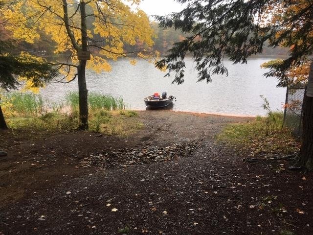
Pettingill Pond covers 36 acres and is located in Windham, Cumberland County, Maine (see The Maine Atlas and Gazetteer map 5 C2). The public access to this body of water can be tricky to find under the snow in the winter. While driving on Route 302 in Windham (direction Raymond and Naples, i.e., north), turn right at the light on Anglers Road just past Bob’s Seafood Restaurant, go down that ruddy road for about 0.4 miles and look for house number 48. The small unmarked dirt public access point will be to your left immediately past that house (and across from house #51). You have gone too far if you reach Mud Pond Road. Note that Anglers Road is narrow, twisty, and trafficky. No vehicles can be parked on it. Route 302 is the only readily-available place to leave your car in that area.

Continue reading

Digiprove sealCopyright protected by Digiprove
Fishing for brown trout on Silver Lake (a.k.a. Figure Eight Pond) in Sidney and Manchester, Kennebec County, Maine (October 12, 2019)

View Map


The boat launch is unimproved, steep, and gravelly…


Silver Lake (a.k.a. Figure Eight Pond) is a 29-acre body of water located in Sidney and Manchester, Kennebec County, Maine (see The Maine Atlas and Gazetteer map 12 B5). To reach this location, drive on Route 27 north (towards Belgrade), turn left on Summerhaven Road, go for about 0.6 miles before turning left on Baxter Drive, drive for about 0.2 miles and turn right on Community Drive. The southern lobe of the pond will soon appear on your right. The public boat launch consists of loose gravel and is otherwise unimproved, but can accommodate small trailered boats. However, keep in mind that the launch is fairly steep; I had to use four-wheel drive to pull my boat up the wet and gravelly incline on my way out. In addition, the water by the launch is rather shallow, which requires backing into the lake a fair bit before the boat will float off. I also had to put on my hip boots to manually guide my boat back on the trailer on account of the shallow depth by the launch. Parking space is limited on Community Drive and occurs along the side of the road next to the launch.

Continue reading

Digiprove sealCopyright protected by Digiprove
Fishing for brown trout on Biscay Pond in Bremen, Lincoln County, Maine (September 28, 2019)

View Map


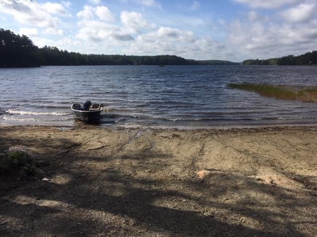
View of the sandy boat launch. The picture does not do justice to the wind howling down the length of the pond.


Biscay Pond is a 377-acre body of water located in Bremen, Lincoln County, Maine (see The Maine Atlas and Gazetteer map 7 A4). To reach this location, drive on Route 1 into downtown Damariscotta, turn onto Biscay Road (by the McDonald’s restaurant), and drive down that road for about 2.5 miles. The pond will appear on your right. The boat launch is sandy and unimproved, but can accommodate large trailered boats. The biggest challenge with this launch is its shallowness, which requires backing your vehicle quite a way into the water before the boat will float. I’m very glad I brought my Jeep and hip boots! Ample parking is available along Biscay Road.

Continue reading

Digiprove sealCopyright protected by Digiprove

Fishing for brown trout and rainbow trout in the Saco River, Glen, Carroll County, New Hampshire (July 6, 2019)

View Map


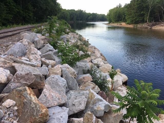
The railroad tracks (upper left) run on top of the embankment which plunges into the Saco River.


I spend the long July the 4th weekend camping with family members at the Glen Ellis Family Campground located right off Route 302 in Glen, NH (see the New Hampshire Atlas and Gazetteer map 45 G9). This well-maintained and well-organized campground sits at the confluence of the Ellis River with the much larger Saco River. I brought my ultralight spinning rod and my flyfishing rod in the hope of catching some trout, although I still have to figure out a good fishing spot close to camp. That location becomes obvious when we rent tubes from the campground to float the Saco River from our camp site all the way to North Conway (the trip takes up to 5 hours, covers about 8 miles, and requires a “return” car). The Conway Scenic Railroad tracks run right along the river bank just downstream of where the Ellis River flows into the Saco River. I suspect, as I look down into the water column when floating by on my tube, that the river along that bank holds trout because it is quite deep (I’m guessing 8+ ft in some spots) and filled with large boulders. The best part is that this choicy spot is an easy 10-minute walk from the campground. From the fresh, but not too cold, feel of the water during our tubing adventure, I’m guessing that the water temperature is in the high 60’s. I note for the record that the Conway Scenic Railroad is a local tourist attraction. Hence, the train only operates during the day and moves at a snail’s pace. It is therefore safe to fish from  that embankment.

Continue reading

Digiprove sealCopyright protected by Digiprove

Fishing for brown trout on Sand Pond in Litchfield, Maine (September 22, 2018)

View Map

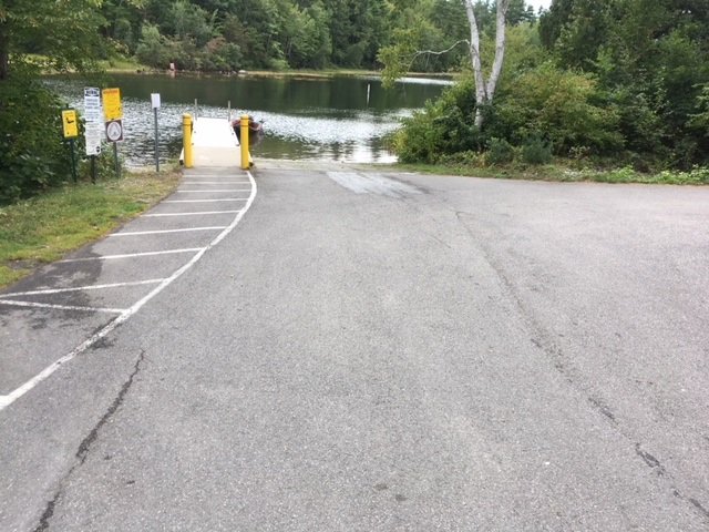
The boat launch on Woodbury Pond is spacious and can accommodate big boats.


Sand Pond covers 177 acres and is located in Litchfield, Kennebec County, Maine (see The Maine Atlas and Gazetteer map 12 D3). This pond does not have its own hard-top public boat launch. The closest one is located at the northern end of Woodbury Pond, which is connected to Sand Pond via a wide underpass over which runs Routes 9 and 126. That public access point can be reached as follows: while driving north on Hallowell Road, turn left on Hardscrabble Road and make an immediate left on Whippoorwill Road. Drive 0.3 miles on this road until you see the blue public access sign to your left. The boat launch is clean, spacious and well-maintained. It provides plenty of parking and also access to a convenient porta potty.
Continue reading

Digiprove sealCopyright protected by Digiprove

Fishing for brown trout on Horne Pond in Limington, Maine (September 16, 2018)

View Map

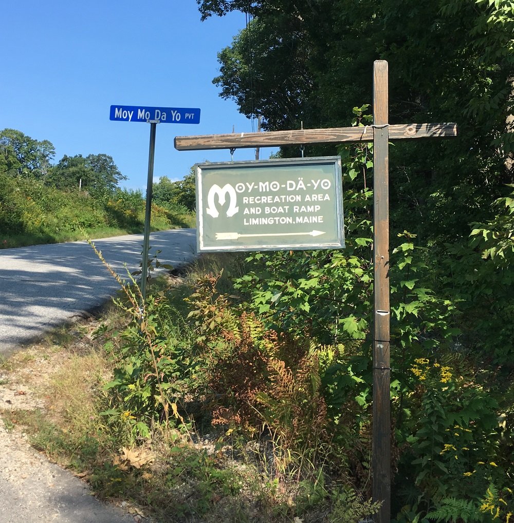
The sign to the boat launch on Horne Pond is clearly marked at the entrance by North Road

Horne Pond (a.k.a Pequawket Lake) covers 166 acres and is located in Limington, York County, Maine (see The Maine Atlas and Gazetteer map 4 D4). The public boat launch can be reached by turning onto Moy Mo Da Yo Road (I swear I didn’t make that name up!), which is the first dirt road on the right side of North Road about 400 ft after you turn onto it from Route 25. The turn-off on North Road is clearly indicated by a large green sign. Drive for another half a mile or so on this dirt road and follow the directions for the boat launch. The launch is hard-topped and can accommodate substantial boats. Ample parking is available nearby.
Continue reading

Digiprove sealCopyright protected by Digiprove

Fishing for brown trout on Hancock Pond in Denmark, Maine (September 15, 2018)

View Map

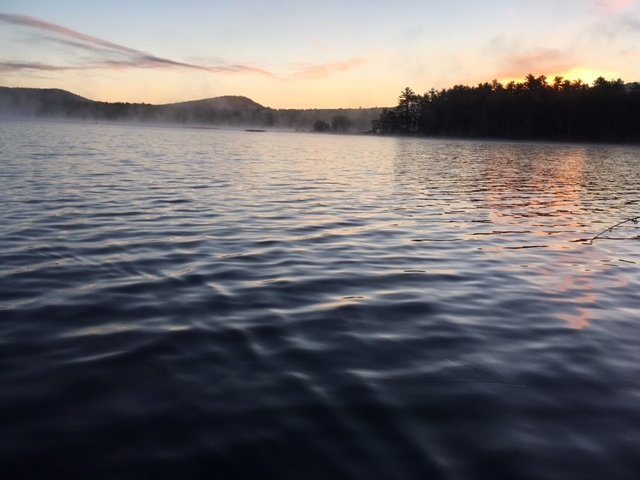
The morning fog is lifting as the sun is about to emerge over Hancock Pond

Hancock Pond covers 858 acres and straddles the boundary between the towns of Sebago and Denmark in Cumberland County and Oxford County, respectively (see The Atlas and Gazetteer map 4 B3 and 4). The public access is located along the eastern shoreline at the intersection of Hancock Pond Road and Wabunaki Road. The boat launch is hard-topped and can accommodate large motorized craft. Ample parking is available on Hancock Pond Road behind the large white electrical switch boxes across from the entrance to the launch. This pond, one of many in southern Maine which are stocked annually with brown trout, is known to grow some serious fish. Click here for a depth map and more fisheries information. I have it on good authority that 6++ pound brown trout behemoths swim around this body of water… This species is hardier than our native brook trout and also does better in the presence of other competing fish species, which is why browns are stocked in “marginal” brook trout waters. However, they are weary creatures and are less likely than brookies to grab artificial lures like spoons. I take advantage of the fact that I can still use live bait before the seasonal rule change on October 1, when only artificial lures are allowed in southern Maine.
Continue reading

Digiprove sealCopyright protected by Digiprove

Fishing for brown trout on the Kennebec River in Madison, Maine (June 16, 2018)

View Map

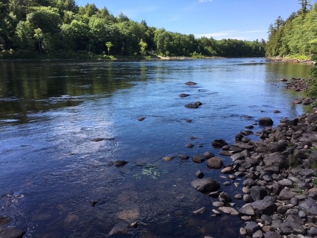
A pretty view of the section of the Kennebec River I’m fishing today. The boat launch on the opposite bank is just visible at the top of the picture

The Kennebec River flowing through downtown Madison and Anson in Somerset County (see the Maine Atlas and Gazetteer map 20 B4) is held back by the Anson and Abnaki dams, before it becomes free-flowing again. It is the free-flowing stretch of the river below the most downstream of these two dams (i.e., the Abenaki Dam) which is the focus of my attention this afternoon. I access the Madison side of the river by driving north on Route 201A into Madison. About half a mile before reaching downtown, I turn left unto Father Rasle Road, cross the unused railroad tracks, and park my car on the sandy shoulder. The river is flowing to my right down a steep slope. My goal is to drop down to the river, wade upstream, and fish for about half a mile up to the hydroelectric dam.

Continue reading

Digiprove sealCopyright protected by Digiprove

Ice fishing for brown trout on Pettingill Pond in Windham, Maine (February 10, 2018)

View Map

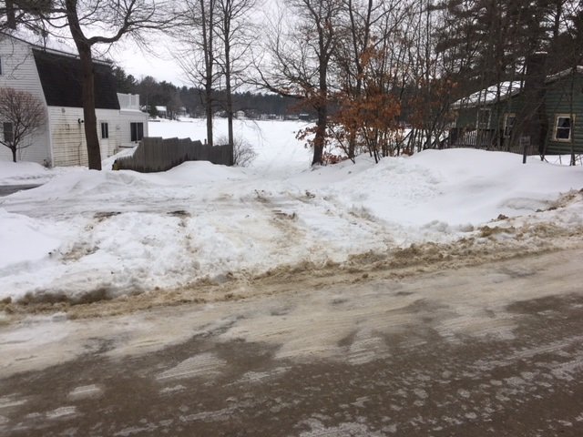
The public access point to Pettingill Pond is unobstrusive and unmarked.

Pettingill Pond covers 42 acres and is located in Windham, Cumberland County, Maine (see The Maine Atlas and Gazetteer map 5 C2). The public access to this body of water can be tricky to find under the snow in the winter. While driving on Route 302 in Windham (direction Raymond and Naples, i.e., north), turn right on Anglers Road at the traffic light just past Bob’s Seafood Restaurant. Go down that road for 0.4 miles and look for house number 48. The access point will be to your left immediately past that house (and across from house #51). It is not indicated by any signs. You have gone too far if you reach Mud Pond Road. Note that the local homeowners frown on people parking their vehicles on Anglers Road, which is quite narrow, twisty, and busy. You can either leave your vehicle by the public access point itself (it will accommodate two or three cars, but no more) or park it on a large plowed area located about 0.1 mile on Anglers Road after the turn-off from Route 302. Note that it may be a problem to pull a sled to the public access point for 0.3 miles if all the snow has been cleared from Anglers Road. I also suspect that this latter parking location may not be available for much longer because I saw a “for sale” sign next to it on my way in this morning.


Continue reading

Digiprove sealCopyright protected by Digiprove

Brook trout and brown trout fishing on the Medomak River in Waldoboro, Maine (May 13, 2017)

View Map

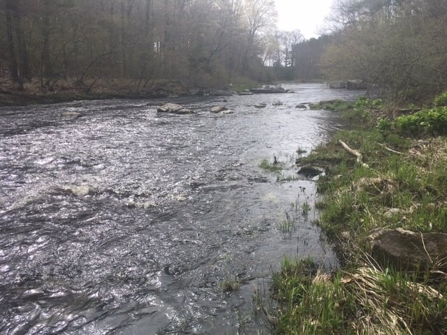
The first half mile of the river downstream of the bridge is swift and rather shallow

The lower reach of the Medomak River flows from Medomak Pond through Waldoboro township (Lincoln County) before it becomes a tidal river downstream of the town of Waldoboro itself. I’m fishing this river because it is one of a select few in southern Maine which was stocked in the spring of 2017 with 13” to 14” one-pound trout. Most of the other streams in the region receive the smaller 9” to 10” trout. Also, because of the larger size of the river, there’s always the chance for catching a bigger holdover fish from last year or the year before. My target for exploration today is the 1.5-mile stretch that runs parallel to Route 32 (Winslow Mills Road) and Wagner Bridge Road (see The Maine Atlas and Gazetteer map 13E5), located about three miles upstream from Waldoboro.


Continue reading

Digiprove sealCopyright protected by Digiprove