Trout fishing on Otter Pond #2, Standish, Maine (November 11, 2012)

View Map

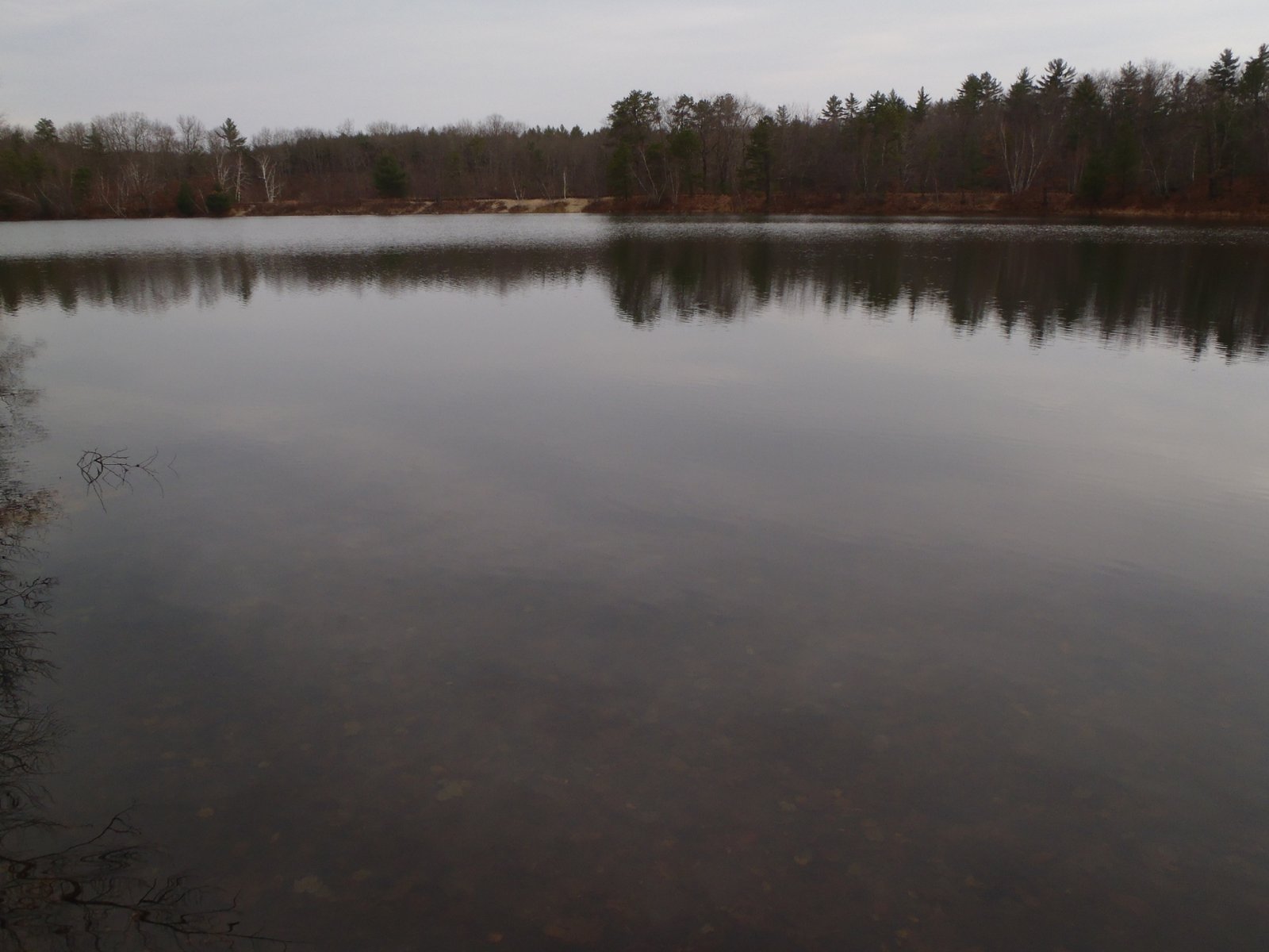
General view of Otter Pond #2, with the railroad tracks in the background

Otter Pond #2 is located in Standish (see The Maine Atlas and Gazetteer map 5 D1). This pond is one of four small ponds located right off Route 35 (Chadbourne Road).  Access to the pond is on foot from the two parking lots located on either side of the bridge over the old railroad tracks. The shortest way in is to walk about a quarter mile on the tracks until the pond appears on the right.  Joel and I instead take the long way in (> 0.5 mile), via the Mountain Division Trail which starts at the largest of the two parking lots. We are wheeling Joel’s canoe, and all our fishing gear, on this nice gravel road which passes next to Otter Pond #2. Our goal today is to troll for trout.


Continue reading

Digiprove sealCopyright protected by Digiprove

Native brook trout fishing in remote ponds in Baxter State Park, Maine

Baxter State Park offers a genuine wilderness setting. Most people know the park for the spectacular Mount Katadhin hike, including the one-of-a-kind Knife’s Edge Trail. Yet Baxter also offers a tremendous variety of outdoors opportunities which I decided to explore in-depth during a five-day hiking/camping/fishing trip with my son Joel in mid-September, 2012. As a serious bonus, the park offers some of the best native brook trout fishing opportunities on unspoiled ponds found anywhere in the state of Maine.

The hike started at Trout Brook Farm, located about 3 miles west of the northern entrance to Baxter State Park at Matagamon Gate (see The Maine Atlas and Gazetteer map 51 A1) and was scheduled to end at the Roaring Brook campground (see The Maine Atlas and Gazetteer map 51 C1). Click here for downloadable maps of the ponds and the hiking trails on this itinerary.

Continue reading

Digiprove sealCopyright protected by Digiprove

Trout fishing on Trout Brook in Baxter State Park, Maine (September 18, 2012)


View Larger Map

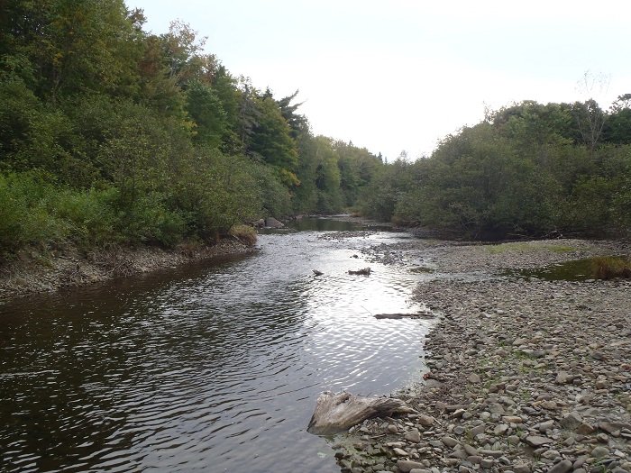
Trout Brook in late summer, Baxter State Park, Maine

Trout Brook in late summer, Baxter State Park, Maine

Trout Brook flows roughly parallel with the Park Tote Road (a.k.a. Perimeter Road) in the northern part of Baxter State Park. The brook originates in the western reaches of the park and empties into Grand Lake Matagamon to the east. The substrate consists mostly of coarse sand, pebbles, and cobbles interspersed by many large boulders. The water has a slightly stained color but is otherwise clear and clean.


Continue reading

Digiprove sealCopyright protected by Digiprove

Trout and salmon fishing on Pierce Pond, Somerset County, Maine (May 28, 2012)

View Map

Click here for the story of the first two days

It’s day 3 of our annual Pierce Pond fishing expedition. Salvador and I are back on Lower Pierce Pond at 5 am to troll for landlocked salmon and brook trout for 1.5 hrs before breakfast (note: the Maine Department of Inland Fisheries and Wildlife stocks the pond with landlocked salmon in the spring. Check the web site associated with this blog for more stocking details). Even though my fish finder is on, I don’t pay enough attention to the bottom contour and end up wedging my trolling weight in a shallow rock pile. It’s a real mess: the wind blows us off the rock pile, my downrigger is jammed, and our fishing lines are scrambled up. It takes us about 20 minutes to untangle the mess which, to our surprise, yields a 12″ brookie for Salvador. The fish must have taken the Mooselook spoon before we got stuck, but was just too small to trigger the release mechanism on the downrigger. It’s hardly glorious, but Salvador finally caught his first trout!

Continue reading

Digiprove sealCopyright protected by Digiprove

Flyfishing for brook trout on Dixon Pond, Somerset County, Maine (May 28, 2012).

View Map

Dixon Pond is a 17-acre body of water nestled on the flank of Pierce Pond Mountain in Pierce Pond Township (see The Maine Atlas and Gazetteer map 30 A1). The pond is remarkably deep for its small size, with a maximum depth of 55 ft. The only way to reach this little jewel is to hike up to it from Pierce Pond via a forest trail. The pond supports a healthy population of native brook trout.

I tie my boat just passed the Caribou Narrows on Middle Pierce Pond and hike the 25-minute to the pond by myself. I love Dixon Pond: its beauty, total isolation, forested surroundings, and fiesty brook trout. The trout don’t get big (the largest one I have caught in this pond over the years was 13″) but eagerly take dry flies. In fact, flyfishing is the only legal way to fish the pond, which suits me just fine.

Continue reading

Digiprove sealCopyright protected by Digiprove

Brook trout fishing on Churchill Lake, Allagash Wilderness Waterway, Maine (May 16, 2012)

View Map

Click here for the Day 2 story

Day 3: It rained non-stop from yesterday 4 pm until 4 am this morning. Everything is wet and damp. Joel and I are back on the Churchill Lake thoroughfare (called Heron Lake; see The Maine Atlas and Gazetteer map 56 A1), at 6:15 am to try our luck one more time. We only have about 4 hours to fish before we need to start packing up at 10:30 am to drive back home. We discuss our options and decide to go after brook trout by the ledges near the camp site, instead of motoring up-lake for 30 minutes to fish for lake trout in the deep part of Churchill Lake.

Continue reading

Digiprove sealCopyright protected by Digiprove

Brook trout fishing on Churchill Lake and Eagle Lake, Allagash Wilderness Waterway, Maine (May 15, 2012)

View Map

Click here for the Day 1 story

Day 2: It’s amazing how much can change in 12 hours! Joel and I are back on the water at 6:30 am to catch the early morning bite on the two ledges we discovered yesterday in Heron Lake (see The Maine Atlas and Gazetteer map 56 A1). This “lake” is the thoroughfare between Churchill Lake and Churchill Dam. We only catch three smallish (12-14″) brookies after 3 hours of hard fishing. The trout have gone missing! It’s clear that the smelts, and their fishy predators, have moved elsewhere.

Continue reading

Digiprove sealCopyright protected by Digiprove

Brook Trout fishing on Churchill Lake, Allagash Wilderness Waterway, Maine (May 14, 2012)

View Map

Churchill Lake is a 3,720 acre impoundment (with a maximum depth of 62 ft) of the Allagash River on the Allagash Wilderness Waterway in northwestern Maine (see The Maine Atlas and Gazetteer map 56 B1). The entire shoreline, which is owned by the State of Maine, is wooded, wild, and entirely undeveloped.  Joel and I drove up to Churchill Dam yesterday from southern Maine (7 hours of driving, of which 3 hours on rutted logging roads…). We put our canoe in the water at the concrete boat launch by the dam and park our car further up the road at a large parking spot. We motor up to the “High Bank” camp site at the end of the thoroughfare, which is also called Heron Lake (see The Maine Atlas and Gazetteer map 56 A1).


We troll for native brook trout using smelt-imitating spoons (Mooselook and the like) between 7 am and 8 pm, for a total of 10.5 hrs. We’re fishing our spoons only 4-5 ft below the surface because the water temperature is a chilly 49F. We use our depth finders to locate two ledges in Heron Lake across from our camp site. The water depth rises from 26 ft up to 7 ft at the top of the ledge and plunges back down to 27 ft at the other end before it rises again to about 9 ft.


The trout are ambushing schools of smelt on both sides of the drop-offs. We quickly become aware of it when we start catching trout after trout which regurgitate smelts when we bring the fish to the boat. The trout are healthy, have distended stomachs, and fight hard. We catch a total of 18 trout, most between 14” and 16″, before the day is over. We keep two smaller brookies for the evening meal. This is definitely high-quality fishing!


The results: I caught 8 brook trout ranging in size from 14” to 16” in 10.5 hours of fishing.


Was the information in this blog useful? I invite you to share your thoughts and opinions by posting a comment. Also, feel free to tell us about your experiences fishing for brook trout on Churchill Lake.

Digiprove sealCopyright protected by Digiprove