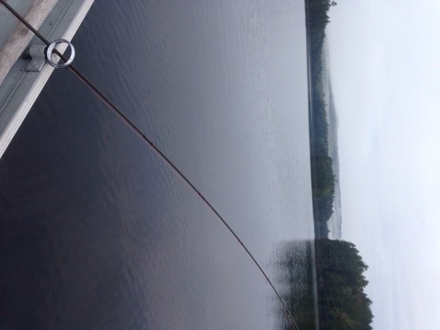
Native brook trout fishing in Baxter State Park: Day 5 (September 30, 2014)

This blog is a continuation of this blog.


DAY 5: From Russell Pond to the Roaring Brook camp ground
View Map

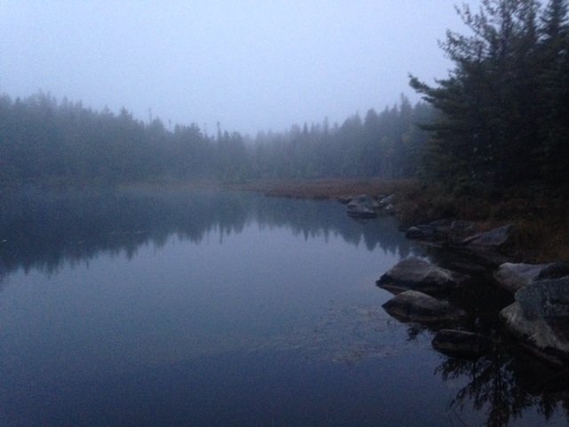
Deep Pond in the early morning fog and mist

Today is unfortunately the last of our memorable five-day Baxter State Park through-hike and native brook trout fishing trip. It is also the last day of the 2014 fishing season in the park. After spending a warm and dry night in the bunk house at the Russell Pond camp site, I get up once more at the crack of down to fish Deep Pond. This water body covers 8 acres and is located an easy 15-20 minute hike from Russell Pond (see the Maine Atlas and Gazetteer map 51 B1). It has a maximum and mean depth of 19 ft and 9 ft, respectively, and is home to an abundant, but stunted, native brook trout population. The water is clear and the shoreline is completely forested. The pond develops an oxygen deficiency in the summer at depths of 12 ft or more which forces the trout to reside in the upper half of the water column during the warm season. Deep Pond could actually be fished comfortably from shore by kids using bobbers and worms.  An enormous flat rock sits at the water’s edge by the canoe launch and can easily accommodate several people. Good casting would place the bait, or a lure, close to the center of the pond. The daily bag limit on trout is five fish with a minimum length limit of 6”. Use or possession of life baitfish is prohibited, but dead fish, salmon eggs, and worms are allowed as bait. Click here for more information on the fishing regulations. Click here for a depth map and more information on the pond and its fisheries.

Continue reading

Digiprove sealCopyright protected by Digiprove
Native brook trout fishing in Baxter State Park: Day 4 (September 29, 2014)

This blog is a continuation of this blog.


DAY 4: Upper South Branch Pond to Russell Pond


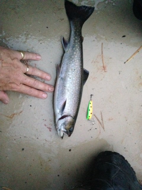
This native brookie for my "psychedelic" spoon

This fat native brookie fell for my “psychedelic” spoon

The cold front, which announced itself yesterday evening, definitely arrived overnight. The wind is blowing hard from the northwest and the sky is completely overcast with a low cloud deck shrouding the nearby Traveler Mountains. But that doesn’t stop me from crawling out of my tent at the crack of dawn for a morning troll on Upper South Branch Pond using lead core line. I’d like to repeat the experience from last evening by catching another brookie. I do hesitate for a moment about fishing alone when I get to the lake shore: paddling the canoe by myself into the stiff wind will be quite a chore. But what the heck: how often do I get to fish this gorgeous pond? I’m richly rewarded in three ways for my tenacity. I land a healthy 13” native brook trout after about 30 minutes trolling with two spoons fished in tandem one color down (just like yesterday evening). I also experience a unique sound effect: the resident loon calls out twice in a row as I pass it by; its haunting song echoes off the surrounding rock cliffs! I stop paddling to soak in this precious moment… Finally, I see a dark shape ambling in the shallow water along the southern (downwind) shoreline of the lake as I troll back towards my starting point. It’s a young bull moose grazing on the aquatic vegetation! Wow, that’s really awesome except that the wind is pushing me straight in the direction of the animal. The canoe acts like a sail whenever I try to turn it sideways… Then one of my lures decides to hang up on the bottom. F*ck!!  I paddle backwards like a madman to retrieve my lures and then turn the canoe sideways and paddle like a maniac to stay away from the moose but parallel to the shoreline. Fortunately, the beast gives me a long dumb look, completely ignores my grunts and paddling shenanigans, and slowly moves on. It’s now 6:50 am and I don’t have the strength left in my arms to battle upwind for another round. I call it good, glad to have caught two nice brook trout in less than 1.5 hours of trolling between yesterday evening and this morning.

Continue reading

Digiprove sealCopyright protected by Digiprove

Native brook trout fishing in Baxter State Park: Day 3 (September 28, 2014)

This blog is a continuation of this blog.


DAY 3: Middle Fowler Pond to Upper South Branch Pond


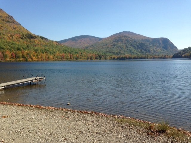
A gorgeous view of the Traveler Mountains from the north shore of Lower South Branch Pond

A gorgeous view of the Traveler Mountains from the north shore of Lower South Branch Pond

The brook trout fishing on Middle Fowler Pond was so incredible yesterday evening that I decide not to fish the same pond again this morning. Instead, we rise at 7 am and get ready for our first “real” hike of our five-day trans Baxter State Park adventure. The trail from our current camp site to the large camp ground at Lower South Branch Pond is only about 5 miles. However, the first half consists of gaining about 1,000 ft to cross over Burrell Ridge. That represents a serious physical effort considering that our backpacks weigh over 40 lbs… We leave Middle Fowler Pond around 9:30 am and have lunch on top of the ridge by noon. The view from up there towards the opposite cliffs is beautiful, but we don’t have a ton of time to waste. Soon, we’re on our way down and reach the ranger station at the outlet of Lower South Branch Pond by 1:30 pm. Our camp site for tonight is located another 2 miles away, at the southern tip of Upper South Branch Pond. That site does not have a canoe. So we rent one from the ranger (we’ll bring it back tomorrow morning), load it up with our gear, and paddle upwind towards the thoroughfare that links the two ponds. We portage the canoe for about a quarter mile to pass the shallow thoroughfare. Note that it is possible to pull the canoe through it as we did in 2012, but at the risk of getting wet feet. Reaching the camp site on Upper South Branch Pond by canoe from the ranger station takes less than one hour.

Continue reading

Digiprove sealCopyright protected by Digiprove

Native brook trout fishing in Baxter State Park: Day 2 (September 27, 2014)

This blog is a continuation of this blog.

DAY 2: Long Pond to Middle Fowler Pond


Today is definitely the “laziest” of our five hiking days. We have to walk for about 2 miles, i.e., no more than one hour, in order to reach our next camp site on Middle Fowler Pond. Hence, we don’t feel the rush to get going this morning. Joel and Salvador are sleeping in, whereas I have a hot date with High Pond (see the Maine Atlas and Gazetteer map 51 A1). I crawl out of my tent at 6 am, well before sunrise, and walk to the canoe storage place. I unlock the canoe and drag it over the spit of land separating Long Pond from High Pond, and gently lower it into the water.

Continue reading

Digiprove sealCopyright protected by Digiprove

Native brook trout fishing in Baxter State Park: Day 1 (September 26, 2014)

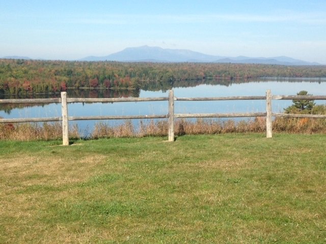
View of Mount Katadhin from south of Millinocket, Maine

View of Mount Katadhin from south of Millinocket, Maine


Baxter State Park (BSP) is the crown jewel of the Maine state park system. Tens of thousands of nature lovers every year make the pilgrimage to northern Maine to enjoy its outstanding beauty. Most people, however, enter this natural wonder at the south end of the park and head straight for Mount Katadhin and its legendary Knife’s Edge, the most spectacular 1.5 mile trail in the northeast. But there’s so much more to BSP than Katadhin! In an effort to expand our horizons and combine our favorite outdoors activities (i.e., hiking, camping, and brook trout fishing), my son Joel and I decided in September 2012 to hike and fish our way across BSP starting at Trout Brook Farm by Matagamon Gate in the north all the way across to Roaring Brook in the south. This adventure was cut short on the third day due to an unfortunate foot injury.


The five blogs that follow tell the story of the successful completion of this trip, which took place between September 26 and 30, 2014. Joel and I were joined by my nephew Salvador on our adventure. The blogs will not repeat all of the background information on how to reserve camp sites at BSP, rent canoes for fishing, identify brook trout ponds, obtain maps, or select hiking trails.

Continue reading

Digiprove sealCopyright protected by Digiprove

Trout and salmon fishing on Pierce Pond, Pierce Pond Township, Maine (May 24 to 27, 2014)

View Map

Cobb's Camp, our headquarters for the next four days

Cobb’s Camp, our headquarters for the next four days

This blog continues the story started here. Salvi and Bill arrive at Cobb’s Camp on Lower Pierce Pond on Saturday morning at 11:30 am for our annual, 4-day fly fishing extravaganza. We all love staying at Cobb’s this time of year to take advantage of the may fly hatches which typically peak on this lake during the long Memorial Day weekend. We move in our own log cabin featuring a warm bed, a wood stove, electric power, running water, a hot shower, and a toilet. Not bad for a near-wilderness setting far off in the Maine woods! Our hosts also serve us three square meals, which includes a bagged lunch to take with us on the water.


Continue reading

Digiprove sealCopyright protected by Digiprove

Fly fishing for trout on Dixon Pond, Pierce Pond Township, Maine (May 25, 2014)

View Map

The flank of Pierce Pond Mountain plunges into Dixon Pond

The flank of Pierce Pond Mountain plunges into Dixon Pond

Dixon Pond is a completely undeveloped 17-acre pond located within the protected Pierce Pond watershed in Somerset County, Maine (see The Maine Atlas and Gazetteer map 30 A1). This water body has an average depth of 26 ft and a maximum depth of 55 ft, which is remarkably deep given the relatively small size of the pond. The main reason is that it abuts the flank of Pierce Pond Mountain which plunges into the southwestern end of the pond. Access is via a rough foot trail which roughly parallels the pond’s outlet. The trail starts at the Caribou Narrows, which is one of the two thoroughfares that link Lower to Middle Pierce Pond. It takes about 25 minutes of easy hiking through the woods to reach Dixon.  Click here for a depth map and more fisheries information.


Continue reading

Digiprove sealCopyright protected by Digiprove

Fly fishing for trout on Split Rock Pond, Bowtown Township, Maine (May 26, 2014)

View Map

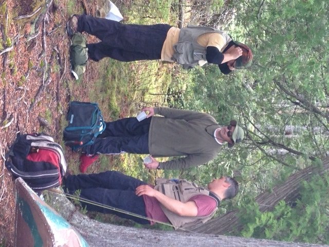
The team strategizing before paddling onto Split Rock Pond...

The team strategizing before paddling onto Split Rock Pond…

Split Rock Pond is a completely undeveloped 6-acre pond nestled on the lower flank of Otter Pond Mountain within the Pierce Pond watershed (see The Maine Atlas and Gazetteer map 30 A2). This shallow water body has an average depth of 5 ft and a maximum depth of 15 ft. The bottom consists mostly of soft organic muck and the water is slightly colored. Access to this pond is via unmarked foot trails through the woods. Click here for a depth map and more fisheries information. The fishing rules are strict, as follows: (a) the pond is closed to ice fishing and is open to fishing from May 1 to September 30; (b) fly fishing only, and (c) the daily bag limit on trout is two fish with a minimum length of 10”, only one of which may exceed 12”.  Click here for more details on the regulations.


Continue reading

Digiprove sealCopyright protected by Digiprove

Trout and salmon fishing on Pierce Pond, Pierce Pond Township, Maine (May 22 to 24, 2014)

View Map

Upper Pierce Pond all to myself during my early-morning troll

Upper Pierce Pond is all mine during my early-morning troll

Pierce Pond is a gem of a lake nestled in the mountains of central Somerset County (see the Maine Atlas and Gazetteer map 30 A2). It consists of three basins (lower, middle and upper) connected by shallow, boulder-infested thoroughfares. The water is crystal clear and its quality is superb. This water body, which covers 1,650 acres, is completely surrounded by a protected forested watershed. Hence, civilization intrudes minimally, except for a few grand-fathered camps in Lindsay Cove. The entire shoreline is deeply wooded and not a single dock or house is visible anywhere, except for Cobb’s CampClick here for a depth map and more fisheries information.


Continue reading

Digiprove sealCopyright protected by Digiprove

Trout fishing on the Kennebunk River in Kennebunk, Maine (May 10, 2014)

View Map

The Kennebunk River upstream of the Route 1 bridge provides great trout habitat

The Kennebunk River upstream of the Route 1 bridge provides great trout habitat

The Kennebunk River has it source in the area of Waterboro, Maine. It flows in a generally southeasterly direction through Kennebunk before emptying out in the Atlantic Ocean in Kennebunkport. Every spring, the State stocks this river three or four times in April and May with (give or take) around 2,000 brook trout and brown trout measuring between 8” and 10”. General fishing rules apply on this body of water. Click here for more details on the regulations.


Continue reading

Digiprove sealCopyright protected by Digiprove